Difference between revisions of "Category:Maps and missions"
m (→Air Forces Maps) |
(→Ground Forces Air Maps: Added Sweden) |
||
| (7 intermediate revisions by 2 users not shown) | |||
| Line 25: | Line 25: | ||
File:MapIcon Ground FrozenPass.jpg|link=Frozen_Pass_(Ground_Forces) | File:MapIcon Ground FrozenPass.jpg|link=Frozen_Pass_(Ground_Forces) | ||
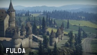
File:MapIcon Ground Fulda.jpg|link=Fulda_(Ground_Forces) | File:MapIcon Ground Fulda.jpg|link=Fulda_(Ground_Forces) | ||
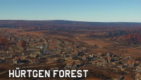
| − | File:MapIcon Ground HurtgenForest.jpg|link= | + | File:MapIcon Ground HurtgenForest.jpg|link=Battle_of_Hurtgen_Forest_(Ground_Forces) |
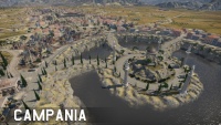
File:MapIcon Ground Italy.jpg|link=Italy_(Ground_Forces) | File:MapIcon Ground Italy.jpg|link=Italy_(Ground_Forces) | ||
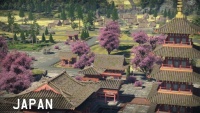
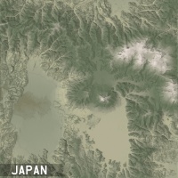
File:MapIcon Ground Japan.jpg|link=Emperors_Garden_Map | File:MapIcon Ground Japan.jpg|link=Emperors_Garden_Map | ||
| Line 44: | Line 44: | ||
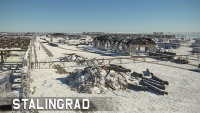
File:MapIcon Ground Stalingrad.jpg|link=Stalingrad_(Ground_Forces) | File:MapIcon Ground Stalingrad.jpg|link=Stalingrad_(Ground_Forces) | ||
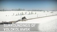
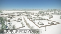
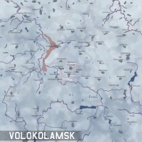
File:MapIcon Ground SurroundingsofVolokolamsk.jpg|link=Surroundings_of_Volokolamsk | File:MapIcon Ground SurroundingsofVolokolamsk.jpg|link=Surroundings_of_Volokolamsk | ||
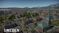
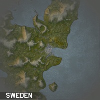
| + | File:MapIcon Ground Sweden.jpg|link=Sweden_(Ground_Forces) | ||
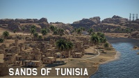
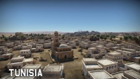
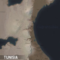
File:MapIcon Ground Tunisia.jpg|link=Tunisia | File:MapIcon Ground Tunisia.jpg|link=Tunisia | ||
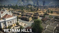
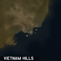
File:MapIcon Ground VietnamHills.jpg|link=Vietnam_Hills | File:MapIcon Ground VietnamHills.jpg|link=Vietnam_Hills | ||
| Line 69: | Line 70: | ||
<center> | <center> | ||
<gallery mode="nolines" widths="200px" heights="200px" style="pointer-events: none"> | <gallery mode="nolines" widths="200px" heights="200px" style="pointer-events: none"> | ||
| − | File: | + | File:MapIcon Air AfricanCanyon.jpg|link= |
| − | File: | + | File:MapIcon Air AfricanCoast.jpg|link= |
| − | File: | + | File:MapIcon Air AlpineMeadows.jpg|link= |
| − | File: | + | File:MapIcon Air CliffedCoast.jpg|link= |
| − | File: | + | File:MapIcon Air Crater.jpg|link= |
| − | File: | + | File:MapIcon Air Fjords.jpg|link= |
| − | File: | + | File:MapIcon Air Foothills.jpg|link= |
| − | File: | + | File:MapIcon Air GraveRobbersCliffs.jpg|link= |
| − | File: | + | File:MapIcon Air Greece.jpg|link= |
| − | File: | + | File:MapIcon Air GreenRidge.jpg|link= |
| − | File: | + | File:MapIcon Air GuianaHighlands.jpg|link= |
| − | File: | + | File:MapIcon Air IronRange.jpg|link= |
| − | File: | + | File:MapIcon Air MountainGorge.jpg|link= |
| − | File: | + | File:MapIcon Air PacificHiddenBase.jpg|link= |
| − | File: | + | File:MapIcon Air RiceTerraces.jpg|link= |
| − | File: | + | File:MapIcon Air TopOfTheWorld.jpg|link= |
</gallery> | </gallery> | ||
</center> | </center> | ||
===General Air Maps=== | ===General Air Maps=== | ||
| − | Most of these maps have configurations for all three air game modes (Arcade, Realistic, and Simulator). They are larger than Arcade maps, generally being between 64 km x 64 km and 131 km x 131 km, with a couple of exceptions. All of these maps are based off of real world locations; the level of accuracy varies between maps, but in general they tend to be reasonably accurate to the real world. | + | Most of these maps have configurations for all three air game modes (Arcade, Realistic, and Simulator). They are larger than Arcade maps, generally being between 64 km x 64 km and 131 km x 131 km, with a couple of exceptions. All of these maps are based off of real world locations; the level of accuracy varies between maps, but in general they tend to be reasonably accurate to the real world. Some of these maps are re-used to form the air battles area of tank maps. |
<center> | <center> | ||
<gallery mode="nolines" widths="200px" heights="200px" style="pointer-events: none"> | <gallery mode="nolines" widths="200px" heights="200px" style="pointer-events: none"> | ||
| − | File: | + | File:MapIcon Air Afghanistan.jpg|link= |
| − | File: | + | File:MapIcon Air Berlin.jpg|link= |
| − | File: | + | File:MapIcon Air Britain.jpg|link=Britain |
| − | File: | + | File:MapIcon Air Bulge.jpg|link= |
| − | File: | + | File:MapIcon Air Denmark.jpg|link= |
| − | File: | + | File:MapIcon Air DoverStrait.jpg|link= |
| − | File: | + | File:MapIcon Air Guadalcanal.jpg|link= |
| − | File: | + | File:MapIcon Air Guam.jpg|link= |
| − | File: | + | File:MapIcon Air Honolulu.jpg|link= |
| − | File: | + | File:MapIcon Air Hurtgen.jpg|link= |
| − | File: | + | File:MapIcon Air IwoJima.jpg|link= |
| − | File: | + | File:MapIcon Air KhalkhinGol.jpg|link= |
| − | File: | + | File:MapIcon Air Korea.jpg|link= |
| − | File: | + | File:MapIcon Air Korsun.jpg|link= |
| − | File: | + | File:MapIcon Air Krymsk.jpg|link= |
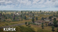
| − | File: | + | File:MapIcon Air Kursk.jpg|link= |
| − | File: | + | File:MapIcon Air Ladoga.jpg|link= |
| − | File: | + | File:MapIcon Air Malta.jpg|link= |
| − | File: | + | File:MapIcon Air Midway.jpg|link= |
| − | File: | + | File:MapIcon Air Moscow.jpg|link= |
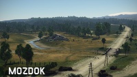
| − | File: | + | File:MapIcon Air Mozdok.jpg|link= |
| − | File: | + | File:MapIcon Air Norway.jpg|link= |
| − | File: | + | File:MapIcon Air Peleliu.jpg|link= |
| − | File: | + | File:MapIcon Air PortMoresby.jpg|link= |
| − | File: | + | File:MapIcon Air Ruhr.jpg|link= |
| − | File: | + | File:MapIcon Air Saipan.jpg|link= |
| − | File: | + | File:MapIcon Air Sicily.jpg|link= |
| − | File: | + | File:MapIcon Air Smolensk.jpg|link= |
| − | File: | + | File:MapIcon Air Spain.jpg|link= |
| − | File: | + | File:MapIcon Air Stalingrad.jpg|link= |
| + | File:MapIcon Air StalingradWinter.jpg|link= | ||
| + | File:MapIcon Air Vietnam.jpg|link= | ||
| + | File:MapIcon Air WakeIsland.jpg|link= | ||
| + | File:MapIcon Air Zhengzhou.jpg|link= | ||
</gallery> | </gallery> | ||
</center> | </center> | ||
| Line 131: | Line 136: | ||
<center> | <center> | ||
<gallery mode="nolines" widths="200px" heights="200px" style="pointer-events: none"> | <gallery mode="nolines" widths="200px" heights="200px" style="pointer-events: none"> | ||
| − | File: | + | File:MapIcon Air PacificOcean.jpg|link= |
| − | File: | + | File:MapIcon Air TropicalIsland.jpg|link= |
</gallery> | </gallery> | ||
</center> | </center> | ||
| Line 140: | Line 145: | ||
<center> | <center> | ||
<gallery mode="nolines" widths="200px" heights="200px"> | <gallery mode="nolines" widths="200px" heights="200px"> | ||
| − | File:MapIcon Air AbandonedFactory.jpg|link= | + | File:MapIcon Air AbandonedFactory.jpg|link=Abandoned_Factory_(Ground_Forces) |
| − | File:MapIcon Air Ardennes.jpg|link= | + | File:MapIcon Air AdvancetotheRhine.jpg|link=Advance_to_the_Rhine |
| − | File:MapIcon Air Carpathians.jpg|link= | + | File:MapIcon Air Alaska.jpg|link=Alaska |
| − | File:MapIcon Air EasternEurope.jpg|link= | + | File:MapIcon Air AmericanDesert.jpg|link=American_Desert |
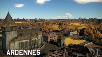
| − | File:MapIcon Air ElAlamein.jpg|link= | + | File:MapIcon Air Ardennes.jpg|link=Ardennes_(Ground_Forces) |
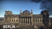
| + | File:MapIcon Air Berlin.jpg|link=Berlin_(Air_Forces) | ||
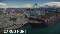
| + | File:MapIcon Air CargoPort.jpg|link=Cargo_Port | ||
| + | File:MapIcon Air Carpathians.jpg|link=Carpathians_(Ground_Forces) | ||
| + | File:MapIcon Air EasternEurope.jpg|link=Eastern_Europe_(Ground_Forces) | ||
| + | File:MapIcon Air ElAlamein.jpg|link=Second_battle_of_El_Alamein_(Ground_Forces) | ||
File:MapIcon Air Finland.jpg|link=Finland | File:MapIcon Air Finland.jpg|link=Finland | ||
| − | File:MapIcon Air FrozenPass.jpg|link= | + | File:MapIcon Air FrozenPass.jpg|link=Frozen_Pass_(Ground_Forces) |
| − | File:MapIcon Air Fulda.jpg|link= | + | File:MapIcon Air Fulda.jpg|link=Fulda_(Ground_Forces) |
| − | File:MapIcon Air HurtgenForest.jpg|link= | + | File:MapIcon Air HurtgenForest.jpg|link=Battle_of_Hurtgen_Forest_(Ground_Forces) |
| − | File:MapIcon Air Japan.jpg|link= | + | File:MapIcon Air Italy.jpg|link=Italy_(Ground_Forces) |
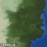
| − | File:MapIcon Air Karelia.jpg|link= | + | File:MapIcon Air Japan.jpg|link=Emperors_Garden_Map |
| − | File:MapIcon Air Korea38th.jpg|link= | + | File:MapIcon Air Karelia.jpg|link=Karelia_(Ground_Forces) |
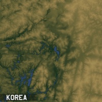
| − | File:MapIcon Air MaginotLine.jpg|link= | + | File:MapIcon Air Korea38th.jpg|link=Korea_(Ground_Forces) |
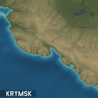
| − | File:MapIcon Air MiddleEast.jpg|link= | + | File:MapIcon Air Krymsk.jpg|link=Kuban_(Ground_Forces) |
| − | File:MapIcon Air Normandy.jpg|link= | + | File:MapIcon Air Kursk.jpg|link=Kursk_(Ground_Forces) |
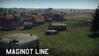
| − | File:MapIcon Air Poland.jpg|link= | + | File:MapIcon Air MaginotLine.jpg|link=Maginot_Line_(Ground_Forces) |
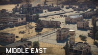
| − | File:MapIcon Air PortNovorossiysk.jpg|link= | + | File:MapIcon Air MiddleEast.jpg|link=Middle_East_(Ground_Forces) |
| + | File:MapIcon Air Mozdok.jpg|link=Mozdok_(Ground_Forces) | ||
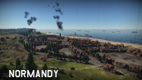
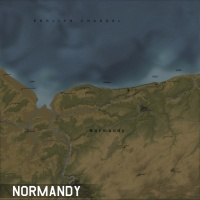
| + | File:MapIcon Air Normandy.jpg|link=Normandy_(Ground_Forces) | ||
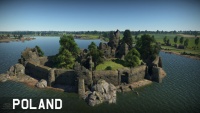
| + | File:MapIcon Air Poland.jpg|link=Poland_(Ground_Forces) | ||
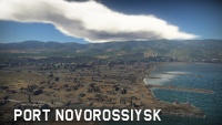
| + | File:MapIcon Air PortNovorossiysk.jpg|link=Port_Novorossiysk | ||
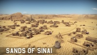
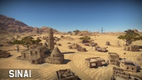
File:MapIcon Air Sinai.jpg|link=Sinai | File:MapIcon Air Sinai.jpg|link=Sinai | ||
| + | File:MapIcon Air Sweden.jpg|link=Sweden_(Ground_Forces) | ||
| + | File:MapIcon Air Tunisia.jpg|link=Tunisia | ||
| + | File:MapIcon Air VietnamHills.jpg|link=Vietnam_Hills | ||
File:MapIcon Air Volokolamsk.jpg|link=Volokolamsk | File:MapIcon Air Volokolamsk.jpg|link=Volokolamsk | ||
| + | File:MapIcon Air WhiteRockFortress.jpg|link=White_Rock_Fortress | ||
| + | </gallery> | ||
| + | </center> | ||
| + | |||
| + | ===Naval Air Maps=== | ||
| + | These maps are the Air Battles area of their respective Naval Maps. | ||
| + | <center> | ||
| + | <gallery mode="nolines" widths="200px" heights="200px" style="pointer-events: none"> | ||
| + | MapIcon Air AfricanGulf.jpg|link= | ||
| + | MapIcon Air AndamanSea.jpg|link= | ||
| + | MapIcon Air ArabianSea.jpg|link= | ||
| + | MapIcon Air BlackSeaPort.jpg|link= | ||
| + | MapIcon Air CoralIslands.jpg|link= | ||
| + | MapIcon Air Fiji.jpg|link= | ||
| + | MapIcon Air FuegoIslands.jpg|link= | ||
| + | MapIcon Air GreenMountainsGulf.jpg|link= | ||
| + | MapIcon Air IrelandBay.jpg|link= | ||
| + | MapIcon Air JapanesePort.jpg|link= | ||
| + | MapIcon Air MediterraneanPort.jpg|link= | ||
| + | MapIcon Air NewZealandCape.jpg|link= | ||
| + | MapIcon Air NorthPort.jpg|link= | ||
| + | MapIcon Air NorthSea.jpg|link= | ||
| + | MapIcon Air NorwayIslands.jpg|link= | ||
| + | MapIcon Air PalauIslands.jpg|link= | ||
| + | MapIcon Air SouthAfrica.jpg|link= | ||
| + | MapIcon Air SouthKvarken.jpg|link= | ||
| + | MapIcon Air VolcanicIsland.jpg|link= | ||
</gallery> | </gallery> | ||
</center> | </center> | ||
==[[:Category:Naval_forces_maps|Naval Forces Maps]]== | ==[[:Category:Naval_forces_maps|Naval Forces Maps]]== | ||
| − | |||
<center> | <center> | ||
| − | <gallery mode="nolines" widths=200px heights=200px> | + | <gallery mode="nolines" widths="200px" heights="200px" style="pointer-events: none"> |
| + | MapIcon Naval AfricanGulf.jpg|link= | ||
| + | MapIcon Naval AndamanSea.jpg|link= | ||
| + | MapIcon Naval ArabianSea.jpg|link= | ||
| + | MapIcon Naval BlackSeaPort.jpg|link= | ||
| + | MapIcon Naval CoralIslands.jpg|link= | ||
| + | MapIcon Naval Fiji.jpg|link= | ||
| + | MapIcon Naval FuegoIslands.jpg|link= | ||
| + | MapIcon Naval GreenMountainsGulf.jpg|link= | ||
| + | MapIcon Naval IrelandBay.jpg|link= | ||
| + | MapIcon Naval JapanesePort.jpg|link= | ||
| + | MapIcon Naval MediterraneanPort.jpg|link= | ||
| + | MapIcon Naval NewZealandCape.jpg|link= | ||
| + | MapIcon Naval NorthPort.jpg|link= | ||
| + | MapIcon Naval NorthSea.jpg|link= | ||
| + | MapIcon Naval NorwayIslands.jpg|link= | ||
| + | MapIcon Naval PalauIslands.jpg|link= | ||
| + | MapIcon Naval SouthAfrica.jpg|link= | ||
| + | MapIcon Naval SouthKvarken.jpg|link= | ||
| + | MapIcon Naval VolcanicIsland.jpg|link= | ||
</gallery> | </gallery> | ||
</center> | </center> | ||
[[Category:Game mechanics]] | [[Category:Game mechanics]] | ||
Revision as of 18:22, 19 June 2020

Contents
Ground Forces Maps
General Ground Forces Maps
Special Ground Forces Maps
These maps are do not occur in normal ground battles. They are only normally available to play in specific game modes / special events, tutorials, or in user made missions.
Air Forces Maps
Arcade Only Air Maps
These maps are (under normal circumstances) only available in Air Arcade Battles. They tend to be small in size compared to other maps (32 km x 32 km or less), and usually contain unrealistic or exaggerated terrain features, to make combat more interesting. They do not aim to recreate real-world locations, although they may take inspiration from them.


General Air Maps
Most of these maps have configurations for all three air game modes (Arcade, Realistic, and Simulator). They are larger than Arcade maps, generally being between 64 km x 64 km and 131 km x 131 km, with a couple of exceptions. All of these maps are based off of real world locations; the level of accuracy varies between maps, but in general they tend to be reasonably accurate to the real world. Some of these maps are re-used to form the air battles area of tank maps.


Special Air Forces Maps
These maps are do not occur in normal air battles. They are only normally available to play in specific game modes / special events, tutorials, or in user made missions.


Ground Forces Air Maps
These maps are the Air Battles area of their respective Tank Maps. As well as being used in combined arms battles, some are also used as standalone maps in air battles (AB, RB & SB), in these cases the tank battles area forms part of the scenery of the map. Being based off tank maps they are a mixture of historically accurate and fictional locations. Maps tend to be 65 km x 65 km, although some are smaller and some are bigger.
These maps are the Air Battles area of their respective Naval Maps.


Subcategories
This category has the following 3 subcategories, out of 3 total.
Pages in category "Maps and missions"
The following 52 pages are in this category, out of 52 total.
