Difference between revisions of "User:DnaGonite/Ground forces maps"
| Line 6: | Line 6: | ||
|img=File:MapIcon_Ground_AbandonedFactory.jpg | |img=File:MapIcon_Ground_AbandonedFactory.jpg | ||
|wiki=Abandoned_Factory_(Ground_Forces) | |wiki=Abandoned_Factory_(Ground_Forces) | ||
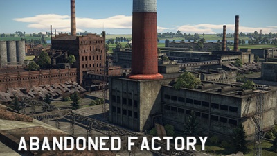
| − | |text= ===[[File: | + | |text= ===[[File:CountryIcon_SUN.png|link=|sub]] Abandoned Factory=== |
''Location: Russia'' | ''Location: Russia'' | ||
| Line 16: | Line 16: | ||
|img=File:MapIcon_Ground_AbandonedTown.jpg | |img=File:MapIcon_Ground_AbandonedTown.jpg | ||
|wiki= | |wiki= | ||
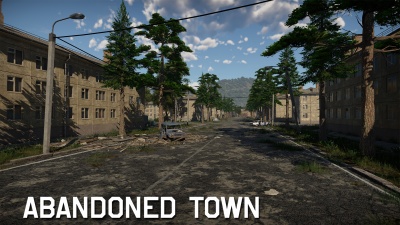
| − | |text= ===[[File: | + | |text= ===[[File:CountryIcon_SUN.png|link=|sub]] Abandoned Town=== |
}} | }} | ||
{{Family-card | {{Family-card | ||
| Line 22: | Line 22: | ||
|img=File:MapIcon_Ground_AdvancetotheRhine.jpg | |img=File:MapIcon_Ground_AdvancetotheRhine.jpg | ||
|wiki=Advance_to_the_Rhine | |wiki=Advance_to_the_Rhine | ||
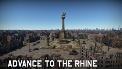
| − | |text= ===[[File: | + | |text= ===[[File:CountryIcon_NDE.png|link=|sub]] Advance to the Rhine=== |
''Location: Cologne, Germany'' | ''Location: Cologne, Germany'' | ||
| Line 32: | Line 32: | ||
|img=File:MapIcon_Ground_Alaska.jpg | |img=File:MapIcon_Ground_Alaska.jpg | ||
|wiki=Alaska | |wiki=Alaska | ||
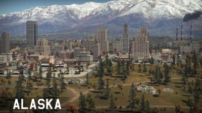
| − | |text= ===[[File: | + | |text= ===[[File:CountryIcon_USA.png|link=|sub]] Alaska=== |
''Location: Alaska, USA'' | ''Location: Alaska, USA'' | ||
| Line 42: | Line 42: | ||
|img=File:MapIcon_Ground_AmericanDesert.jpg | |img=File:MapIcon_Ground_AmericanDesert.jpg | ||
|wiki=American_Desert | |wiki=American_Desert | ||
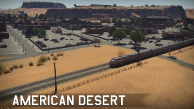
| − | |text= ===[[File: | + | |text= ===[[File:CountryIcon_USA.png|link=|sub]] American Desert=== |
''Location: Arizona, USA'' | ''Location: Arizona, USA'' | ||
| − | Located in Arizona, USA; American Desert | + | Located in Arizona, USA; American Desert represents a quiet village in the American desert. With a roundabout at the centre, the train station to one flank, and the other flank representing the outskirts of the village. |
}} | }} | ||
{{Family-card | {{Family-card | ||
| Line 52: | Line 52: | ||
|img=File:MapIcon_Ground_AralSea.jpg | |img=File:MapIcon_Ground_AralSea.jpg | ||
|wiki= | |wiki= | ||
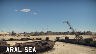
| − | |text= ===[[File: | + | |text= ===[[File:CountryIcon_SUN.png|link=|sub]] Aral Sea=== |
| + | |||
| + | ''Location: Aral Sea, pre-dissolution USSR (now between Kazakhstan and Uzbekistan)'' | ||
}} | }} | ||
{{Family-card | {{Family-card | ||
| Line 58: | Line 60: | ||
|img=File:MapIcon_Ground_Ardennes.jpg | |img=File:MapIcon_Ground_Ardennes.jpg | ||
|wiki=Ardennes_(Ground_Forces) | |wiki=Ardennes_(Ground_Forces) | ||
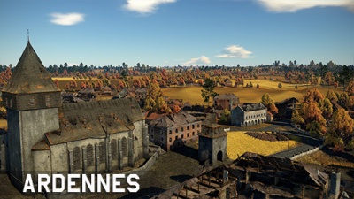
| − | |text= ===[[File: | + | |text= ===[[File:CountryIcon_BEL.png|link=|sub]] Ardennes=== |
''Location: Bastogne, Belgium'' | ''Location: Bastogne, Belgium'' | ||
| Line 68: | Line 70: | ||
|img=File:MapIcon_Ground_AshRiver.jpg | |img=File:MapIcon_Ground_AshRiver.jpg | ||
|wiki=Ash_River | |wiki=Ash_River | ||
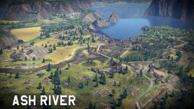
| − | |text= ===[[File: | + | |text= ===[[File:CountryIcon_IRL.png|link=|sub]] Ash River=== |
''Location: Ireland'' | ''Location: Ireland'' | ||
| Line 78: | Line 80: | ||
|img=File:MapIcon_Ground_Berlin.jpg | |img=File:MapIcon_Ground_Berlin.jpg | ||
|wiki=Berlin_(Ground_Forces) | |wiki=Berlin_(Ground_Forces) | ||
| − | |text= ===[[File: | + | |text= ===[[File:CountryIcon_NDE.png|link=|sub]] Berlin=== |
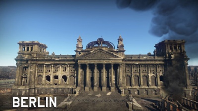
''Location: Berlin, Germany'' | ''Location: Berlin, Germany'' | ||
| − | Located in Berlin, Germany; Berlin takes inspiration from the 1945 Battle for the Reichstag, or the Battle of Berlin. At the centre one can find cover alongside a shallow river, to the west side one can fight over the ruins of the urban environment that once surrounded the Kroll Opera House, while at the east of the river one can find the | + | Located in Berlin, Germany; Berlin takes inspiration from the 1945 Battle for the Reichstag, or the Battle of Berlin. At the centre one can find cover alongside a shallow river, to the west side one can fight over the ruins of the urban environment that once surrounded the Kroll Opera House, while at the east of the river one can find the imposing Reichstag which provides limited cover from the open field surrounding it. Further east one can find the Brandenburg Gate. |
}} | }} | ||
{{Family-card | {{Family-card | ||
| Line 88: | Line 90: | ||
|img=File:MapIcon_Ground_Breslau.jpg | |img=File:MapIcon_Ground_Breslau.jpg | ||
|wiki= | |wiki= | ||
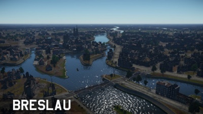
| − | |text= ===[[File: | + | |text= ===[[File:CountryIcon_POL.png|link=|sub]] Breslau=== |
}} | }} | ||
{{Family-card | {{Family-card | ||
| Line 104: | Line 106: | ||
|img=File:MapIcon_Ground_Carpathians.jpg | |img=File:MapIcon_Ground_Carpathians.jpg | ||
|wiki=Carpathians_(Ground_Forces) | |wiki=Carpathians_(Ground_Forces) | ||
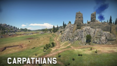
| − | |text= ===[[File: | + | |text= ===[[File:CountryIcon_POL.png|link=|sub]] Carpathians=== |
''Location: Poland'' | ''Location: Poland'' | ||
| Line 114: | Line 116: | ||
|img=File:MapIcon_Ground_EasternEurope.jpg | |img=File:MapIcon_Ground_EasternEurope.jpg | ||
|wiki=Eastern_Europe_(Ground_Forces) | |wiki=Eastern_Europe_(Ground_Forces) | ||
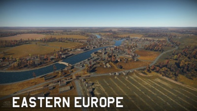
| − | |text= ===[[File: | + | |text= ===[[File:CountryIcon_SUN.png|link=|sub]] Eastern Europe=== |
''Location: Ukraine'' | ''Location: Ukraine'' | ||
| Line 124: | Line 126: | ||
|img=File:MapIcon_Ground_ElAlamein.jpg | |img=File:MapIcon_Ground_ElAlamein.jpg | ||
|wiki=Second_battle_of_El_Alamein_(Ground_Forces) | |wiki=Second_battle_of_El_Alamein_(Ground_Forces) | ||
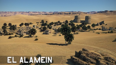
| − | |text= ===[[File: | + | |text= ===[[File:CountryIcon_GBR.png|link=|sub]] Second Battle of El Alamein=== |
''Location: El Alamein, Egypt'' | ''Location: El Alamein, Egypt'' | ||
| Line 134: | Line 136: | ||
|img=File:MapIcon_Ground_EuropeanProvince.jpg | |img=File:MapIcon_Ground_EuropeanProvince.jpg | ||
|wiki=European_Province | |wiki=European_Province | ||
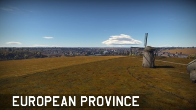
| − | |text= ===[[File: | + | |text= ===[[File:CountryIcon_SUN.png|link=|sub]] European Province=== |
''Location: Ukraine'' | ''Location: Ukraine'' | ||
| Line 144: | Line 146: | ||
|img=File:MapIcon_Ground_Finland.jpg | |img=File:MapIcon_Ground_Finland.jpg | ||
|wiki=Finland | |wiki=Finland | ||
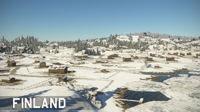
| − | |text= ===[[File: | + | |text= ===[[File:CountryIcon_FIN.png|link=|sub]] Finland=== |
''Location: Kiviniemi, pre-war Finland (now Losevo, modern-day Russia)'' | ''Location: Kiviniemi, pre-war Finland (now Losevo, modern-day Russia)'' | ||
| Line 154: | Line 156: | ||
|img=File:MapIcon_Ground_FrozenPass.jpg | |img=File:MapIcon_Ground_FrozenPass.jpg | ||
|wiki=Frozen_Pass_(Ground_Forces) | |wiki=Frozen_Pass_(Ground_Forces) | ||
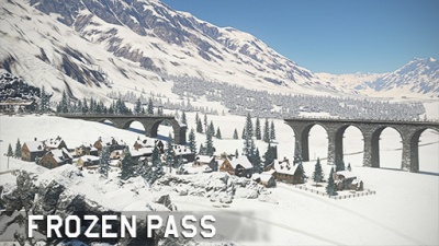
| − | |text= ===[[File: | + | |text= ===[[File:CountryIcon_NDE.png|link=|sub]] Frozen Pass=== |
''Location: Austria'' | ''Location: Austria'' | ||
| Line 164: | Line 166: | ||
|img=File:MapIcon_Ground_Fulda.jpg | |img=File:MapIcon_Ground_Fulda.jpg | ||
|wiki=Fulda_(Ground_Forces) | |wiki=Fulda_(Ground_Forces) | ||
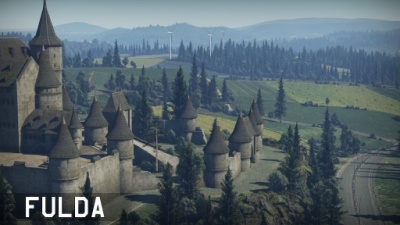
| − | |text= ===[[File: | + | |text= ===[[File:CountryIcon_DEU.png|link=|sub]] Fulda Gap=== |
''Location: Rasdorf, Germany'' | ''Location: Rasdorf, Germany'' | ||
| Line 174: | Line 176: | ||
|img=File:MapIcon_Ground_HurtgenForest.jpg | |img=File:MapIcon_Ground_HurtgenForest.jpg | ||
|wiki=Battle_of_Hurtgen_Forest_(Ground_Forces) | |wiki=Battle_of_Hurtgen_Forest_(Ground_Forces) | ||
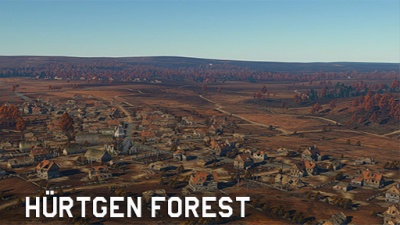
| − | |text= ===[[File: | + | |text= ===[[File:CountryIcon_NDE.png|link=|sub]] Battle of Hürtgen Forest=== |
''Location: Vossenack, Germany'' | ''Location: Vossenack, Germany'' | ||
| Line 184: | Line 186: | ||
|img=File:MapIcon_Ground_Italy.jpg | |img=File:MapIcon_Ground_Italy.jpg | ||
|wiki=Italy_(Ground_Forces) | |wiki=Italy_(Ground_Forces) | ||
| − | |text= ===[[File: | + | |text= ===[[File:CountryIcon_ITA.png|link=|sub]] Italy=== |
''Location: Calabria, Italy'' | ''Location: Calabria, Italy'' | ||
| Line 193: | Line 195: | ||
|title= | |title= | ||
|img=File:MapIcon_Ground_Japan.jpg | |img=File:MapIcon_Ground_Japan.jpg | ||
| − | |wiki= | + | |wiki=Japan (Ground Forces) |
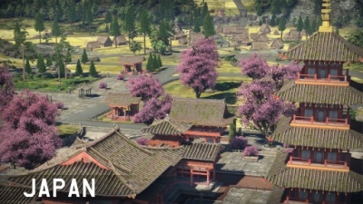
| − | |text= ===[[File: | + | |text= ===[[File:CountryIcon_JPN.png|link=|sub]] Japan=== |
''Location: Japan'' | ''Location: Japan'' | ||
| Line 204: | Line 206: | ||
|img=File:MapIcon_Ground_Jungle.jpg | |img=File:MapIcon_Ground_Jungle.jpg | ||
|wiki=Jungle | |wiki=Jungle | ||
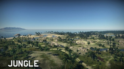
| − | |text= ===[[File: | + | |text= ===[[File:CountryIcon_GBR.png|link=|sub]] Jungle=== |
''Location: Guadalcanal, Solomon Islands'' | ''Location: Guadalcanal, Solomon Islands'' | ||
| Line 214: | Line 216: | ||
|img=File:MapIcon_Ground_Karelia.jpg | |img=File:MapIcon_Ground_Karelia.jpg | ||
|wiki=Karelia_(Ground_Forces) | |wiki=Karelia_(Ground_Forces) | ||
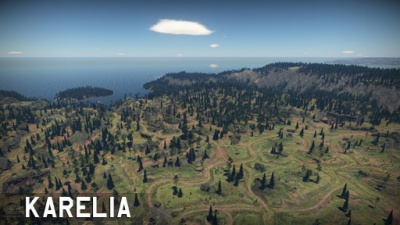
| − | |text= ===[[File: | + | |text= ===[[File:CountryIcon_FIN.png|link=|sub]] Karelia=== |
''Location: Karelia, pre-war Finland (now Karelia, modern-day Russia)'' | ''Location: Karelia, pre-war Finland (now Karelia, modern-day Russia)'' | ||
| Line 224: | Line 226: | ||
|img=File:MapIcon_Ground_Korea.jpg | |img=File:MapIcon_Ground_Korea.jpg | ||
|wiki=Korea_(Ground_Forces) | |wiki=Korea_(Ground_Forces) | ||
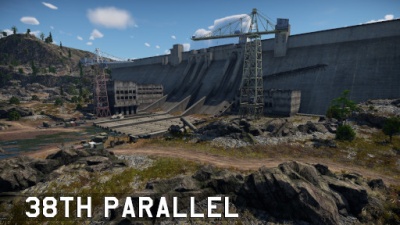
| − | |text= ===[[File: | + | |text= ===[[File:CountryIcon_KOR.png|link=|sub]] 38th Parallel=== |
''Location: South Korea'' | ''Location: South Korea'' | ||
| Line 233: | Line 235: | ||
|img=File:MapIcon_Ground_Kuban.jpg | |img=File:MapIcon_Ground_Kuban.jpg | ||
|wiki=Kuban_(Ground_Forces) | |wiki=Kuban_(Ground_Forces) | ||
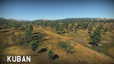
| − | |text= ===[[File: | + | |text= ===[[File:CountryIcon_SUN.png|link=|sub]] Kuban=== |
''Location: Krymsk, Russia'' | ''Location: Krymsk, Russia'' | ||
| Line 243: | Line 245: | ||
|img=File:MapIcon_Ground_Kursk.jpg | |img=File:MapIcon_Ground_Kursk.jpg | ||
|wiki=Kursk_(Ground_Forces) | |wiki=Kursk_(Ground_Forces) | ||
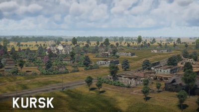
| − | |text= ===[[File: | + | |text= ===[[File:CountryIcon_SUN.png|link=|sub]] Kursk=== |
''Location: Prokhorovka, Russia'' | ''Location: Prokhorovka, Russia'' | ||
| Line 253: | Line 255: | ||
|img=File:MapIcon_Ground_MaginotLine.jpg | |img=File:MapIcon_Ground_MaginotLine.jpg | ||
|wiki=Maginot_Line_(Ground_Forces) | |wiki=Maginot_Line_(Ground_Forces) | ||
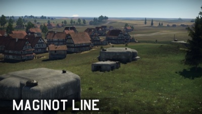
| − | |text= ===[[File: | + | |text= ===[[File:CountryIcon_FRA.png|link=|sub]] Maginot Line=== |
''Location: Sedan, France'' | ''Location: Sedan, France'' | ||
| Line 263: | Line 265: | ||
|img=File:MapIcon_Ground_MiddleEast.jpg | |img=File:MapIcon_Ground_MiddleEast.jpg | ||
|wiki=Middle_East_(Ground_Forces) | |wiki=Middle_East_(Ground_Forces) | ||
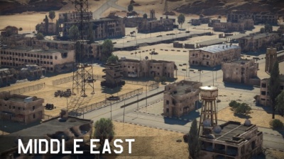
| − | |text= ===[[File: | + | |text= ===[[File:CountryIcon_SYR.png|link=|sub]] Middle East=== |
''Location: Syria'' | ''Location: Syria'' | ||
| Line 273: | Line 275: | ||
|img=File:MapIcon_Ground_Mozdok.jpg | |img=File:MapIcon_Ground_Mozdok.jpg | ||
|wiki=Mozdok_(Ground_Forces) | |wiki=Mozdok_(Ground_Forces) | ||
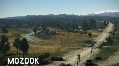
| − | |text= ===[[File: | + | |text= ===[[File:CountryIcon_SUN.png|link=|sub]] Mozdok=== |
''Location: Mozdok, Russia'' | ''Location: Mozdok, Russia'' | ||
| Line 283: | Line 285: | ||
|img=File:MapIcon_Ground_Normandy.jpg | |img=File:MapIcon_Ground_Normandy.jpg | ||
|wiki=Normandy_(Ground_Forces) | |wiki=Normandy_(Ground_Forces) | ||
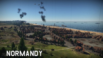
| − | |text= ===[[File: | + | |text= ===[[File:CountryIcon_FRA.png|link=|sub]] Normandy=== |
''Location: Vierville-sur-Mer, France'' | ''Location: Vierville-sur-Mer, France'' | ||
| Line 293: | Line 295: | ||
|img=File:MapIcon_Ground_FieldsofNormandy.jpg | |img=File:MapIcon_Ground_FieldsofNormandy.jpg | ||
|wiki=Fields_of_Normandy | |wiki=Fields_of_Normandy | ||
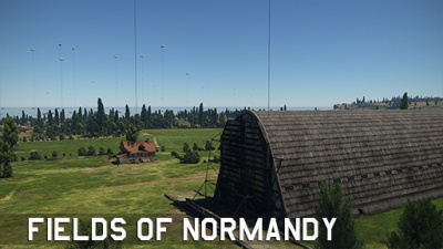
| − | |text= ===[[File: | + | |text= ===[[File:CountryIcon_FRA.png|link=|sub]] Fields of Normandy=== |
''Location: Vierville-sur-Mer, France'' | ''Location: Vierville-sur-Mer, France'' | ||
| Line 303: | Line 305: | ||
|img=File:MapIcon_Ground_Poland.jpg | |img=File:MapIcon_Ground_Poland.jpg | ||
|wiki=Poland_(Ground_Forces) | |wiki=Poland_(Ground_Forces) | ||
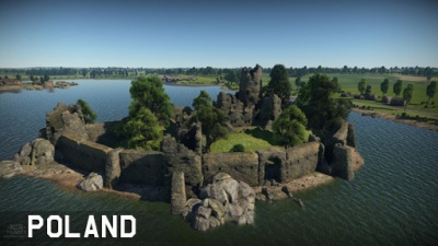
| − | |text= ===[[File: | + | |text= ===[[File:CountryIcon_POL.png|link=|sub]] Poland=== |
''Location: Poland'' | ''Location: Poland'' | ||
| Line 313: | Line 315: | ||
|img=File:MapIcon_Ground_FieldsofPoland.jpg | |img=File:MapIcon_Ground_FieldsofPoland.jpg | ||
|wiki=Fields_of_Poland | |wiki=Fields_of_Poland | ||
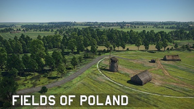
| − | |text= ===[[File: | + | |text= ===[[File:CountryIcon_POL.png|link=|sub]] Fields of Poland=== |
''Location: Poland'' | ''Location: Poland'' | ||
| Line 323: | Line 325: | ||
|img=File:MapIcon_Ground_PortNovorossiysk.jpg | |img=File:MapIcon_Ground_PortNovorossiysk.jpg | ||
|wiki=Port_Novorossiysk | |wiki=Port_Novorossiysk | ||
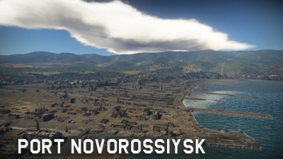
| − | |text= ===[[File: | + | |text= ===[[File:CountryIcon_SUN.png|link=|sub]] Port Novorossiysk=== |
''Location: Novorossiysk, Russia'' | ''Location: Novorossiysk, Russia'' | ||
| Line 339: | Line 341: | ||
|img=File:MapIcon_Ground_Seversk-13.jpg | |img=File:MapIcon_Ground_Seversk-13.jpg | ||
|wiki= | |wiki= | ||
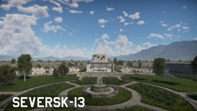
| − | |text= ===[[File: | + | |text= ===[[File:CountryIcon_SUN.png|link=|sub]] Seversk-13=== |
}} | }} | ||
{{Family-card | {{Family-card | ||
| Line 345: | Line 347: | ||
|img=File:MapIcon_Ground_Sinai.jpg | |img=File:MapIcon_Ground_Sinai.jpg | ||
|wiki=Sinai | |wiki=Sinai | ||
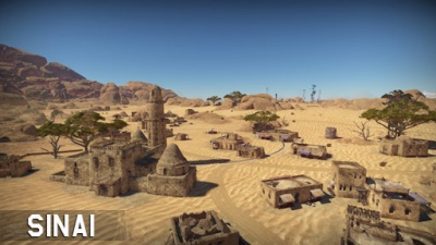
| − | |text= ===[[File: | + | |text= ===[[File:CountryIcon_GBR.png|link=|sub]] Sinai=== |
''Location: Southeast of Suez, Egypt'' | ''Location: Southeast of Suez, Egypt'' | ||
| Line 355: | Line 357: | ||
|img=File:MapIcon_Ground_SandsofSinai.jpg | |img=File:MapIcon_Ground_SandsofSinai.jpg | ||
|wiki=Sands_of_Sinai | |wiki=Sands_of_Sinai | ||
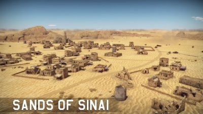
| − | |text= ===[[File: | + | |text= ===[[File:CountryIcon_GBR.png|link=|sub]] Sands of Sinai=== |
''Location: Southeast of Suez, Egypt'' | ''Location: Southeast of Suez, Egypt'' | ||
| Line 371: | Line 373: | ||
|img=File:MapIcon_Ground_Stalingrad.jpg | |img=File:MapIcon_Ground_Stalingrad.jpg | ||
|wiki=Stalingrad_(Ground_Forces) | |wiki=Stalingrad_(Ground_Forces) | ||
| − | |text= ===[[File: | + | |text= ===[[File:CountryIcon_SUN.png|link=|sub]] Stalingrad=== |
''Location: Stalingrad, Russia'' | ''Location: Stalingrad, Russia'' | ||
| Line 387: | Line 389: | ||
|img=File:MapIcon_Ground_Sweden.jpg | |img=File:MapIcon_Ground_Sweden.jpg | ||
|wiki=Sweden_(Ground_Forces) | |wiki=Sweden_(Ground_Forces) | ||
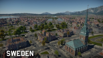
| − | |text= ===[[File: | + | |text= ===[[File:CountryIcon_SWE.png|link=|sub]] Sweden=== |
''Location: Stockholm, Sweden'' | ''Location: Stockholm, Sweden'' | ||
| Line 397: | Line 399: | ||
|img=File:MapIcon_Ground_Tunisia.jpg | |img=File:MapIcon_Ground_Tunisia.jpg | ||
|wiki=Tunisia | |wiki=Tunisia | ||
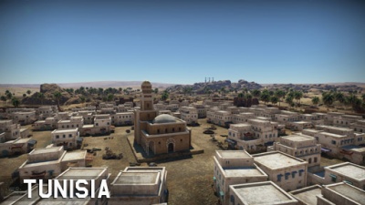
| − | |text= ===[[File: | + | |text= ===[[File:CountryIcon_TN.png|link=|sub]] Tunisia=== |
''Location: North of Gabès, French Tunisia'' | ''Location: North of Gabès, French Tunisia'' | ||
| Line 407: | Line 409: | ||
|img=File:MapIcon_Ground_SandsofTunisia.jpg | |img=File:MapIcon_Ground_SandsofTunisia.jpg | ||
|wiki=Sands_of_Tunisia | |wiki=Sands_of_Tunisia | ||
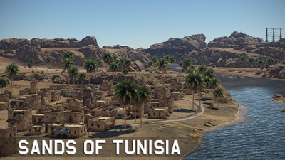
| − | |text= ===[[File: | + | |text= ===[[File:CountryIcon_TN.png|link=|sub]] Sands of Tunisia=== |
''Location: North of Gabès, French Tunisia'' | ''Location: North of Gabès, French Tunisia'' | ||
| Line 417: | Line 419: | ||
|img=File:MapIcon_Ground_VietnamHills.jpg | |img=File:MapIcon_Ground_VietnamHills.jpg | ||
|wiki=Vietnam_Hills | |wiki=Vietnam_Hills | ||
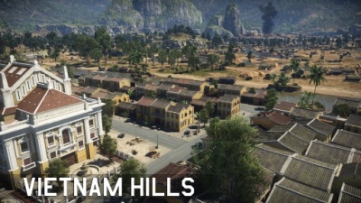
| − | |text= ===[[File: | + | |text= ===[[File:CountryIcon_VNM.png|link=|sub]] Vietnam Hills=== |
''Location: Hội An, Vietnam'' | ''Location: Hội An, Vietnam'' | ||
| Line 427: | Line 429: | ||
|img=File:MapIcon_Ground_Volokolamsk.jpg | |img=File:MapIcon_Ground_Volokolamsk.jpg | ||
|wiki=Volokolamsk | |wiki=Volokolamsk | ||
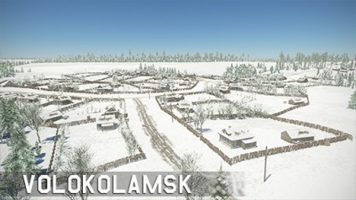
| − | |text= ===[[File: | + | |text= ===[[File:CountryIcon_SUN.png|link=|sub]] Volokolamsk=== |
''Location: Volokolamsk, Russia'' | ''Location: Volokolamsk, Russia'' | ||
| Line 437: | Line 439: | ||
|img=File:MapIcon_Ground_SurroundingsofVolokolamsk.jpg | |img=File:MapIcon_Ground_SurroundingsofVolokolamsk.jpg | ||
|wiki=Surroundings_of_Volokolamsk | |wiki=Surroundings_of_Volokolamsk | ||
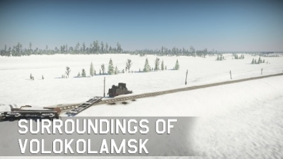
| − | |text= ===[[File: | + | |text= ===[[File:CountryIcon_SUN.png|link=|sub]] Surroundings of Volokolamsk=== |
''Location: Volokolamsk, Russia'' | ''Location: Volokolamsk, Russia'' | ||
| Line 447: | Line 449: | ||
|img=File:MapIcon_Ground_Wallonia.jpg | |img=File:MapIcon_Ground_Wallonia.jpg | ||
|wiki=Wallonia | |wiki=Wallonia | ||
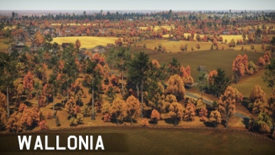
| − | |text= ===[[File: | + | |text= ===[[File:CountryIcon_BEL.png|link=|sub]] Wallonia=== |
''Location: Bastogne, Belgium'' | ''Location: Bastogne, Belgium'' | ||
| Line 457: | Line 459: | ||
|img=File:MapIcon_Ground_WhiteRockFortress.jpg | |img=File:MapIcon_Ground_WhiteRockFortress.jpg | ||
|wiki=White_Rock_Fortress | |wiki=White_Rock_Fortress | ||
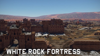
| − | |text= ===[[File: | + | |text= ===[[File:CountryIcon_SUN.png|link=|sub]] White Rock Fortress=== |
''Location: Brest, Belarus'' | ''Location: Brest, Belarus'' | ||
Revision as of 17:08, 31 August 2022
|
|
|
|
|
|
|
|
|
|
|
|
|
|
|
|
|
|
|
|
|
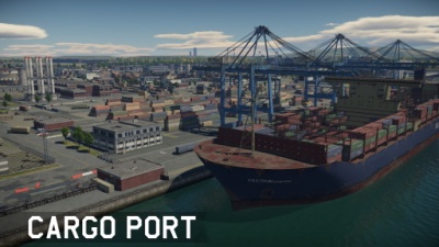
Cargo PortLocation: Fictional Cargo Port is a fictional environment based around a shipment facility. To the north one can find an airfield cut by the long highway. The middle is dominated by buildings while to the south one can find longways separated by containers. |
|
|
|
|
|
|
|
|
|
|
|
|
|
|
|
|
|
|
|
|
|
|
|
|
|
|
|
|
|
|
|
|
|
|
|
|
|
|
|
|
|
|
|
|
|
|
|
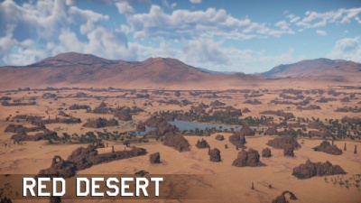
Red Desert |
|
|
|
|
|
|
|
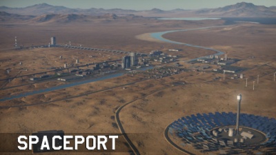
Spaceport |

|
|
|
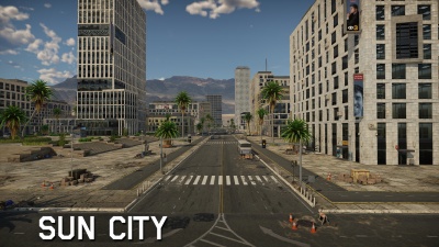
Sun City |
|
|
|
|
|
|
|
|
|
|
|
|
|
|
|
|
