Difference between revisions of "User:DnaGonite/Ground forces maps"
| (2 intermediate revisions by the same user not shown) | |||
| Line 2: | Line 2: | ||
[[#Carpathians]] | [[#Carpathians]] | ||
__NOTOC__ | __NOTOC__ | ||
| + | {{Family-card | ||
| + | |title= | ||
| + | |img=File:MapIcon_Ground_Korea.jpg | ||
| + | |wiki=Korea_(Ground_Forces) | ||
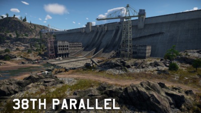
| + | |text= ===[[File:CountryIcon_KOR.png|link=|sub]] 38th Parallel=== | ||
| + | |||
| + | ''Location: South Korea'' | ||
| + | |||
| + | Located in what is now South Korea; the map is composed of the dam to the east, which is overlooked by two cliffs, one to the north and another to the south, a military camp at the centre, which is overlooked by rice terraces to the north and south and overlooked by a rocky hill to the west, and a small village to the west, which is also overlooked by the same rocky hill. | ||
| + | }} | ||
{{Family-card | {{Family-card | ||
|title= | |title= | ||
|img=File:MapIcon_Ground_AbandonedFactory.jpg | |img=File:MapIcon_Ground_AbandonedFactory.jpg | ||
|wiki=Abandoned_Factory_(Ground_Forces) | |wiki=Abandoned_Factory_(Ground_Forces) | ||
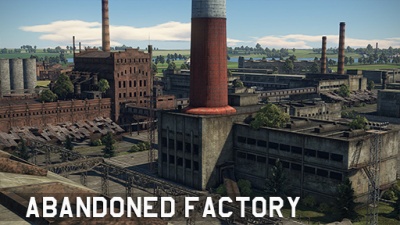
| − | |text= ===[[File: | + | |text= ===[[File:CountryIcon_SUN.png|link=|sub]] Abandoned Factory=== |
''Location: Russia'' | ''Location: Russia'' | ||
Located in Russia; the map consists of paved roads and a multitude of factory buildings all around, the later of which can prove useful as cover. To the south one can find a riverbank, while a small forest is located to the north. | Located in Russia; the map consists of paved roads and a multitude of factory buildings all around, the later of which can prove useful as cover. To the south one can find a riverbank, while a small forest is located to the north. | ||
| + | }} | ||
| + | {{Family-card | ||
| + | |title= | ||
| + | |img=File:MapIcon_Ground_AbandonedTown.jpg | ||
| + | |wiki= | ||
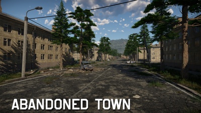
| + | |text= ===[[File:CountryIcon_SUN.png|link=|sub]] Abandoned Town=== | ||
}} | }} | ||
{{Family-card | {{Family-card | ||
| Line 16: | Line 32: | ||
|img=File:MapIcon_Ground_AdvancetotheRhine.jpg | |img=File:MapIcon_Ground_AdvancetotheRhine.jpg | ||
|wiki=Advance_to_the_Rhine | |wiki=Advance_to_the_Rhine | ||
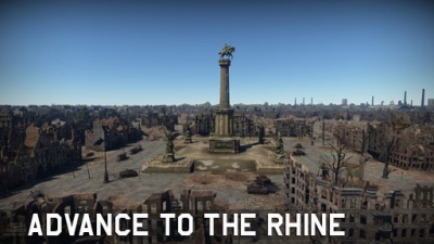
| − | |text= ===[[File: | + | |text= ===[[File:CountryIcon_NDE.png|link=|sub]] Advance to the Rhine=== |
''Location: Cologne, Germany'' | ''Location: Cologne, Germany'' | ||
| Line 26: | Line 42: | ||
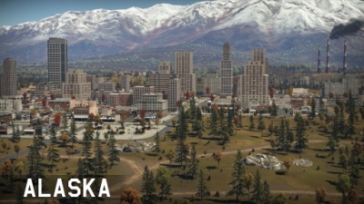
|img=File:MapIcon_Ground_Alaska.jpg | |img=File:MapIcon_Ground_Alaska.jpg | ||
|wiki=Alaska | |wiki=Alaska | ||
| − | |text= ===[[File: | + | |text= ===[[File:CountryIcon_USA.png|link=|sub]] Alaska=== |
''Location: Alaska, USA'' | ''Location: Alaska, USA'' | ||
| Line 36: | Line 52: | ||
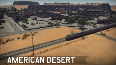
|img=File:MapIcon_Ground_AmericanDesert.jpg | |img=File:MapIcon_Ground_AmericanDesert.jpg | ||
|wiki=American_Desert | |wiki=American_Desert | ||
| − | |text= ===[[File: | + | |text= ===[[File:CountryIcon_USA.png|link=|sub]] American Desert=== |
''Location: Arizona, USA'' | ''Location: Arizona, USA'' | ||
| − | Located in Arizona, USA; American Desert | + | Located in Arizona, USA; American Desert represents a quiet village in the American desert. With a roundabout at the centre, the train station to one flank, and the other flank representing the outskirts of the village. |
}} | }} | ||
{{Family-card | {{Family-card | ||
| Line 46: | Line 62: | ||
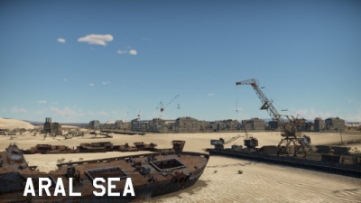
|img=File:MapIcon_Ground_AralSea.jpg | |img=File:MapIcon_Ground_AralSea.jpg | ||
|wiki= | |wiki= | ||
| − | |text= ===[[File: | + | |text= ===[[File:CountryIcon_SUN.png|link=|sub]] Aral Sea=== |
| + | |||
| + | ''Location: Aral Sea, pre-dissolution USSR (now between Kazakhstan and Uzbekistan)'' | ||
}} | }} | ||
{{Family-card | {{Family-card | ||
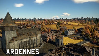
| Line 52: | Line 70: | ||
|img=File:MapIcon_Ground_Ardennes.jpg | |img=File:MapIcon_Ground_Ardennes.jpg | ||
|wiki=Ardennes_(Ground_Forces) | |wiki=Ardennes_(Ground_Forces) | ||
| − | |text= ===[[File: | + | |text= ===[[File:CountryIcon_BEL.png|link=|sub]] Ardennes=== |
''Location: Bastogne, Belgium'' | ''Location: Bastogne, Belgium'' | ||
| Line 62: | Line 80: | ||
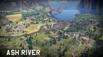
|img=File:MapIcon_Ground_AshRiver.jpg | |img=File:MapIcon_Ground_AshRiver.jpg | ||
|wiki=Ash_River | |wiki=Ash_River | ||
| − | |text= ===[[File: | + | |text= ===[[File:CountryIcon_IRL.png|link=|sub]] Ash River=== |
''Location: Ireland'' | ''Location: Ireland'' | ||
| Line 72: | Line 90: | ||
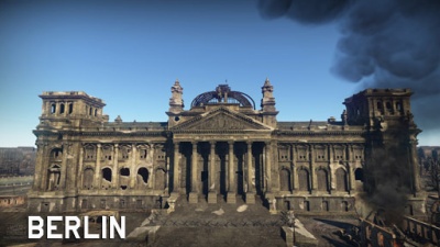
|img=File:MapIcon_Ground_Berlin.jpg | |img=File:MapIcon_Ground_Berlin.jpg | ||
|wiki=Berlin_(Ground_Forces) | |wiki=Berlin_(Ground_Forces) | ||
| − | |text= ===[[File: | + | |text= ===[[File:CountryIcon_NDE.png|link=|sub]] Berlin=== |
''Location: Berlin, Germany'' | ''Location: Berlin, Germany'' | ||
| − | Located in Berlin, Germany; Berlin takes inspiration from the 1945 Battle for the Reichstag, or the Battle of Berlin. At the centre one can find cover alongside a shallow river, to the west side one can fight over the ruins of the urban environment that once surrounded the Kroll Opera House, while at the east of the river one can find the | + | Located in Berlin, Germany; Berlin takes inspiration from the 1945 Battle for the Reichstag, or the Battle of Berlin. At the centre one can find cover alongside a shallow river, to the west side one can fight over the ruins of the urban environment that once surrounded the Kroll Opera House, while at the east of the river one can find the imposing Reichstag which provides limited cover from the open field surrounding it. Further east one can find the Brandenburg Gate. |
}} | }} | ||
{{Family-card | {{Family-card | ||
| Line 82: | Line 100: | ||
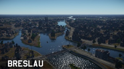
|img=File:MapIcon_Ground_Breslau.jpg | |img=File:MapIcon_Ground_Breslau.jpg | ||
|wiki= | |wiki= | ||
| − | |text= ===[[File: | + | |text= ===[[File:CountryIcon_POL.png|link=|sub]] Breslau=== |
| + | |||
| + | ''Location: Breslau, pre-war Germany (now Wrocław, modern-day Poland)'' | ||
| + | }} | ||
| + | {{Family-card | ||
| + | |title= | ||
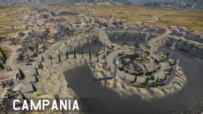
| + | |img=File:MapIcon_Ground_Italy.jpg | ||
| + | |wiki=Campania | ||
| + | |text= ===[[File:CountryIcon_ITA.png|link=|sub]] Campania=== | ||
| + | |||
| + | ''Location: Calabria, Italy'' | ||
| + | |||
| + | Located in Calabria, Italy; the map consists of a long city surrounded by a river to the north, hills to the east and west and another river that leads to a waterfall to the south. | ||
}} | }} | ||
{{Family-card | {{Family-card | ||
| Line 98: | Line 128: | ||
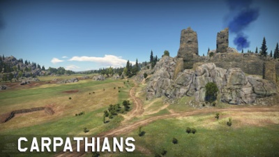
|img=File:MapIcon_Ground_Carpathians.jpg | |img=File:MapIcon_Ground_Carpathians.jpg | ||
|wiki=Carpathians_(Ground_Forces) | |wiki=Carpathians_(Ground_Forces) | ||
| − | |text= ===[[File: | + | |text= ===[[File:CountryIcon_POL.png|link=|sub]] Carpathians=== |
''Location: Poland'' | ''Location: Poland'' | ||
| Line 108: | Line 138: | ||
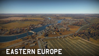
|img=File:MapIcon_Ground_EasternEurope.jpg | |img=File:MapIcon_Ground_EasternEurope.jpg | ||
|wiki=Eastern_Europe_(Ground_Forces) | |wiki=Eastern_Europe_(Ground_Forces) | ||
| − | |text= ===[[File: | + | |text= ===[[File:CountryIcon_SUN.png|link=|sub]] Eastern Europe=== |
''Location: Ukraine'' | ''Location: Ukraine'' | ||
| Line 118: | Line 148: | ||
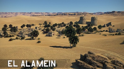
|img=File:MapIcon_Ground_ElAlamein.jpg | |img=File:MapIcon_Ground_ElAlamein.jpg | ||
|wiki=Second_battle_of_El_Alamein_(Ground_Forces) | |wiki=Second_battle_of_El_Alamein_(Ground_Forces) | ||
| − | |text= ===[[File: | + | |text= ===[[File:CountryIcon_GBR.png|link=|sub]] Second Battle of El Alamein=== |
''Location: El Alamein, Egypt'' | ''Location: El Alamein, Egypt'' | ||
| Line 128: | Line 158: | ||
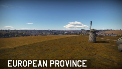
|img=File:MapIcon_Ground_EuropeanProvince.jpg | |img=File:MapIcon_Ground_EuropeanProvince.jpg | ||
|wiki=European_Province | |wiki=European_Province | ||
| − | |text= ===[[File: | + | |text= ===[[File:CountryIcon_SUN.png|link=|sub]] European Province=== |
''Location: Ukraine'' | ''Location: Ukraine'' | ||
| Line 138: | Line 168: | ||
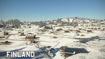
|img=File:MapIcon_Ground_Finland.jpg | |img=File:MapIcon_Ground_Finland.jpg | ||
|wiki=Finland | |wiki=Finland | ||
| − | |text= ===[[File: | + | |text= ===[[File:CountryIcon_FIN.png|link=|sub]] Finland=== |
''Location: Kiviniemi, pre-war Finland (now Losevo, modern-day Russia)'' | ''Location: Kiviniemi, pre-war Finland (now Losevo, modern-day Russia)'' | ||
| Line 148: | Line 178: | ||
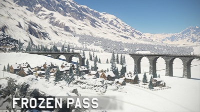
|img=File:MapIcon_Ground_FrozenPass.jpg | |img=File:MapIcon_Ground_FrozenPass.jpg | ||
|wiki=Frozen_Pass_(Ground_Forces) | |wiki=Frozen_Pass_(Ground_Forces) | ||
| − | |text= ===[[File: | + | |text= ===[[File:CountryIcon_NDE.png|link=|sub]] Frozen Pass=== |
''Location: Austria'' | ''Location: Austria'' | ||
| Line 158: | Line 188: | ||
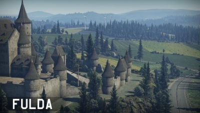
|img=File:MapIcon_Ground_Fulda.jpg | |img=File:MapIcon_Ground_Fulda.jpg | ||
|wiki=Fulda_(Ground_Forces) | |wiki=Fulda_(Ground_Forces) | ||
| − | |text= ===[[File: | + | |text= ===[[File:CountryIcon_DEU.png|link=|sub]] Fulda Gap=== |
''Location: Rasdorf, Germany'' | ''Location: Rasdorf, Germany'' | ||
| Line 168: | Line 198: | ||
|img=File:MapIcon_Ground_HurtgenForest.jpg | |img=File:MapIcon_Ground_HurtgenForest.jpg | ||
|wiki=Battle_of_Hurtgen_Forest_(Ground_Forces) | |wiki=Battle_of_Hurtgen_Forest_(Ground_Forces) | ||
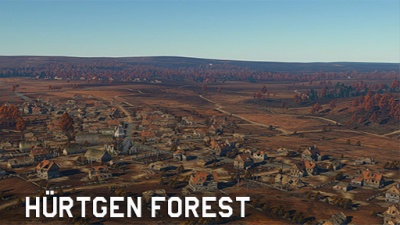
| − | |text= ===[[File: | + | |text= ===[[File:CountryIcon_NDE.png|link=|sub]] Battle of Hürtgen Forest=== |
''Location: Vossenack, Germany'' | ''Location: Vossenack, Germany'' | ||
Located in Vossenack, Germany; Battle of Hürtgen Forest takes inspiration from its 1944 real-life counterpart. Located 5 km east of the border with Belgium, the map consists of a town at its core. To the north one can find a forested hill while to the south a shallow river stream surrounded by forested hills is located. | Located in Vossenack, Germany; Battle of Hürtgen Forest takes inspiration from its 1944 real-life counterpart. Located 5 km east of the border with Belgium, the map consists of a town at its core. To the north one can find a forested hill while to the south a shallow river stream surrounded by forested hills is located. | ||
| − | |||
| − | |||
| − | |||
| − | |||
| − | |||
| − | |||
| − | |||
| − | |||
| − | |||
| − | |||
}} | }} | ||
{{Family-card | {{Family-card | ||
|title= | |title= | ||
|img=File:MapIcon_Ground_Japan.jpg | |img=File:MapIcon_Ground_Japan.jpg | ||
| − | |wiki= | + | |wiki=Japan (Ground Forces) |
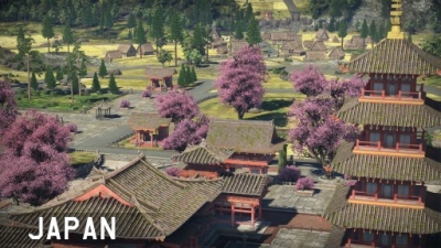
| − | |text= ===[[File: | + | |text= ===[[File:CountryIcon_JPN.png|link=|sub]] Japan=== |
''Location: Japan'' | ''Location: Japan'' | ||
| Line 198: | Line 218: | ||
|img=File:MapIcon_Ground_Jungle.jpg | |img=File:MapIcon_Ground_Jungle.jpg | ||
|wiki=Jungle | |wiki=Jungle | ||
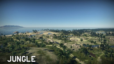
| − | |text= ===[[File: | + | |text= ===[[File:CountryIcon_GBR.png|link=|sub]] Jungle=== |
''Location: Guadalcanal, Solomon Islands'' | ''Location: Guadalcanal, Solomon Islands'' | ||
| Line 208: | Line 228: | ||
|img=File:MapIcon_Ground_Karelia.jpg | |img=File:MapIcon_Ground_Karelia.jpg | ||
|wiki=Karelia_(Ground_Forces) | |wiki=Karelia_(Ground_Forces) | ||
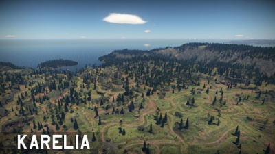
| − | |text= ===[[File: | + | |text= ===[[File:CountryIcon_FIN.png|link=|sub]] Karelia=== |
''Location: Karelia, pre-war Finland (now Karelia, modern-day Russia)'' | ''Location: Karelia, pre-war Finland (now Karelia, modern-day Russia)'' | ||
Located in Karelia, Finland before World War II, nowadays modern-day Russia; Karelia is composed of a large deep canyon to the east, a rocky hill at the middle, and an open terrain to the west, the latter of which can be navigated through paths concealed by trees and small hills. | Located in Karelia, Finland before World War II, nowadays modern-day Russia; Karelia is composed of a large deep canyon to the east, a rocky hill at the middle, and an open terrain to the west, the latter of which can be navigated through paths concealed by trees and small hills. | ||
| − | |||
| − | |||
| − | |||
| − | |||
| − | |||
| − | |||
| − | |||
| − | |||
| − | |||
}} | }} | ||
{{Family-card | {{Family-card | ||
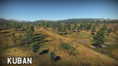
| Line 227: | Line 238: | ||
|img=File:MapIcon_Ground_Kuban.jpg | |img=File:MapIcon_Ground_Kuban.jpg | ||
|wiki=Kuban_(Ground_Forces) | |wiki=Kuban_(Ground_Forces) | ||
| − | |text= ===[[File: | + | |text= ===[[File:CountryIcon_SUN.png|link=|sub]] Kuban=== |
''Location: Krymsk, Russia'' | ''Location: Krymsk, Russia'' | ||
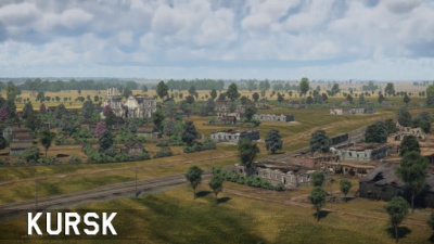
| Line 237: | Line 248: | ||
|img=File:MapIcon_Ground_Kursk.jpg | |img=File:MapIcon_Ground_Kursk.jpg | ||
|wiki=Kursk_(Ground_Forces) | |wiki=Kursk_(Ground_Forces) | ||
| − | |text= ===[[File: | + | |text= ===[[File:CountryIcon_SUN.png|link=|sub]] Kursk=== |
''Location: Prokhorovka, Russia'' | ''Location: Prokhorovka, Russia'' | ||
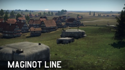
| Line 247: | Line 258: | ||
|img=File:MapIcon_Ground_MaginotLine.jpg | |img=File:MapIcon_Ground_MaginotLine.jpg | ||
|wiki=Maginot_Line_(Ground_Forces) | |wiki=Maginot_Line_(Ground_Forces) | ||
| − | |text= ===[[File: | + | |text= ===[[File:CountryIcon_FRA.png|link=|sub]] Maginot Line=== |
''Location: Sedan, France'' | ''Location: Sedan, France'' | ||
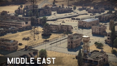
| Line 257: | Line 268: | ||
|img=File:MapIcon_Ground_MiddleEast.jpg | |img=File:MapIcon_Ground_MiddleEast.jpg | ||
|wiki=Middle_East_(Ground_Forces) | |wiki=Middle_East_(Ground_Forces) | ||
| − | |text= ===[[File: | + | |text= ===[[File:CountryIcon_SYR.png|link=|sub]] Middle East=== |
''Location: Syria'' | ''Location: Syria'' | ||
| Line 267: | Line 278: | ||
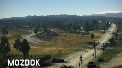
|img=File:MapIcon_Ground_Mozdok.jpg | |img=File:MapIcon_Ground_Mozdok.jpg | ||
|wiki=Mozdok_(Ground_Forces) | |wiki=Mozdok_(Ground_Forces) | ||
| − | |text= ===[[File: | + | |text= ===[[File:CountryIcon_SUN.png|link=|sub]] Mozdok=== |
''Location: Mozdok, Russia'' | ''Location: Mozdok, Russia'' | ||
| Line 277: | Line 288: | ||
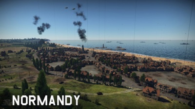
|img=File:MapIcon_Ground_Normandy.jpg | |img=File:MapIcon_Ground_Normandy.jpg | ||
|wiki=Normandy_(Ground_Forces) | |wiki=Normandy_(Ground_Forces) | ||
| − | |text= ===[[File: | + | |text= ===[[File:CountryIcon_FRA.png|link=|sub]] Normandy=== |
''Location: Vierville-sur-Mer, France'' | ''Location: Vierville-sur-Mer, France'' | ||
| Line 287: | Line 298: | ||
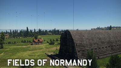
|img=File:MapIcon_Ground_FieldsofNormandy.jpg | |img=File:MapIcon_Ground_FieldsofNormandy.jpg | ||
|wiki=Fields_of_Normandy | |wiki=Fields_of_Normandy | ||
| − | |text= ===[[File: | + | |text= ===[[File:CountryIcon_FRA.png|link=|sub]] Fields of Normandy=== |
''Location: Vierville-sur-Mer, France'' | ''Location: Vierville-sur-Mer, France'' | ||
| Line 297: | Line 308: | ||
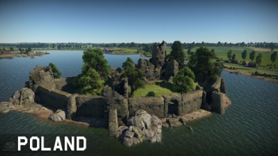
|img=File:MapIcon_Ground_Poland.jpg | |img=File:MapIcon_Ground_Poland.jpg | ||
|wiki=Poland_(Ground_Forces) | |wiki=Poland_(Ground_Forces) | ||
| − | |text= ===[[File: | + | |text= ===[[File:CountryIcon_POL.png|link=|sub]] Poland=== |
''Location: Poland'' | ''Location: Poland'' | ||
| Line 307: | Line 318: | ||
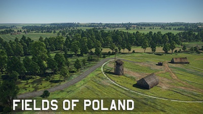
|img=File:MapIcon_Ground_FieldsofPoland.jpg | |img=File:MapIcon_Ground_FieldsofPoland.jpg | ||
|wiki=Fields_of_Poland | |wiki=Fields_of_Poland | ||
| − | |text= ===[[File: | + | |text= ===[[File:CountryIcon_POL.png|link=|sub]] Fields of Poland=== |
''Location: Poland'' | ''Location: Poland'' | ||
| Line 317: | Line 328: | ||
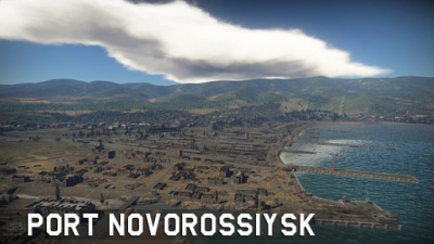
|img=File:MapIcon_Ground_PortNovorossiysk.jpg | |img=File:MapIcon_Ground_PortNovorossiysk.jpg | ||
|wiki=Port_Novorossiysk | |wiki=Port_Novorossiysk | ||
| − | |text= ===[[File: | + | |text= ===[[File:CountryIcon_SUN.png|link=|sub]] Port Novorossiysk=== |
''Location: Novorossiysk, Russia'' | ''Location: Novorossiysk, Russia'' | ||
| Line 333: | Line 344: | ||
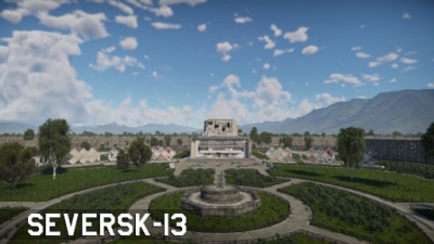
|img=File:MapIcon_Ground_Seversk-13.jpg | |img=File:MapIcon_Ground_Seversk-13.jpg | ||
|wiki= | |wiki= | ||
| − | |text= ===[[File: | + | |text= ===[[File:CountryIcon_SUN.png|link=|sub]] Seversk-13=== |
}} | }} | ||
{{Family-card | {{Family-card | ||
| Line 339: | Line 350: | ||
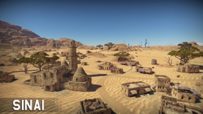
|img=File:MapIcon_Ground_Sinai.jpg | |img=File:MapIcon_Ground_Sinai.jpg | ||
|wiki=Sinai | |wiki=Sinai | ||
| − | |text= ===[[File: | + | |text= ===[[File:CountryIcon_GBR.png|link=|sub]] Sinai=== |
''Location: Southeast of Suez, Egypt'' | ''Location: Southeast of Suez, Egypt'' | ||
| Line 349: | Line 360: | ||
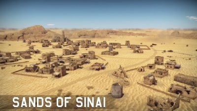
|img=File:MapIcon_Ground_SandsofSinai.jpg | |img=File:MapIcon_Ground_SandsofSinai.jpg | ||
|wiki=Sands_of_Sinai | |wiki=Sands_of_Sinai | ||
| − | |text= ===[[File: | + | |text= ===[[File:CountryIcon_GBR.png|link=|sub]] Sands of Sinai=== |
''Location: Southeast of Suez, Egypt'' | ''Location: Southeast of Suez, Egypt'' | ||
| Line 365: | Line 376: | ||
|img=File:MapIcon_Ground_Stalingrad.jpg | |img=File:MapIcon_Ground_Stalingrad.jpg | ||
|wiki=Stalingrad_(Ground_Forces) | |wiki=Stalingrad_(Ground_Forces) | ||
| − | |text= ===[[File: | + | |text= ===[[File:CountryIcon_SUN.png|link=|sub]] Stalingrad=== |
''Location: Stalingrad, Russia'' | ''Location: Stalingrad, Russia'' | ||
Located in Stalingrad, nowadays known as Volgograd, Russia; the map is inspired on the famous World War II Battle of Stalingrad. The north-west area consists of factory complexes which have been damaged and provide places for units to hide. In the middle of the map, one can find the railway stations, further east, one can find a number of ruined apartment complexes as well as an oil complex, which is overlooked by a couple of hills further south. Further lake the frozen river provides concealed passage. | Located in Stalingrad, nowadays known as Volgograd, Russia; the map is inspired on the famous World War II Battle of Stalingrad. The north-west area consists of factory complexes which have been damaged and provide places for units to hide. In the middle of the map, one can find the railway stations, further east, one can find a number of ruined apartment complexes as well as an oil complex, which is overlooked by a couple of hills further south. Further lake the frozen river provides concealed passage. | ||
| + | }} | ||
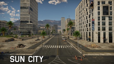
| + | {{Family-card | ||
| + | |title= | ||
| + | |img=File:MapIcon_Ground_SunCity.jpg | ||
| + | |wiki= | ||
| + | |text= ===Sun City=== | ||
}} | }} | ||
{{Family-card | {{Family-card | ||
| Line 375: | Line 392: | ||
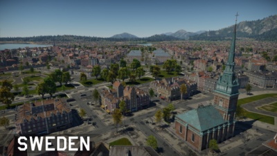
|img=File:MapIcon_Ground_Sweden.jpg | |img=File:MapIcon_Ground_Sweden.jpg | ||
|wiki=Sweden_(Ground_Forces) | |wiki=Sweden_(Ground_Forces) | ||
| − | |text= ===[[File: | + | |text= ===[[File:CountryIcon_SWE.png|link=|sub]] Sweden=== |
''Location: Stockholm, Sweden'' | ''Location: Stockholm, Sweden'' | ||
| Line 385: | Line 402: | ||
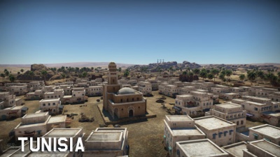
|img=File:MapIcon_Ground_Tunisia.jpg | |img=File:MapIcon_Ground_Tunisia.jpg | ||
|wiki=Tunisia | |wiki=Tunisia | ||
| − | |text= ===[[File: | + | |text= ===[[File:CountryIcon_TN.png|link=|sub]] Tunisia=== |
''Location: North of Gabès, French Tunisia'' | ''Location: North of Gabès, French Tunisia'' | ||
| Line 395: | Line 412: | ||
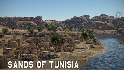
|img=File:MapIcon_Ground_SandsofTunisia.jpg | |img=File:MapIcon_Ground_SandsofTunisia.jpg | ||
|wiki=Sands_of_Tunisia | |wiki=Sands_of_Tunisia | ||
| − | |text= ===[[File: | + | |text= ===[[File:CountryIcon_TN.png|link=|sub]] Sands of Tunisia=== |
''Location: North of Gabès, French Tunisia'' | ''Location: North of Gabès, French Tunisia'' | ||
| Line 405: | Line 422: | ||
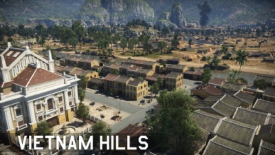
|img=File:MapIcon_Ground_VietnamHills.jpg | |img=File:MapIcon_Ground_VietnamHills.jpg | ||
|wiki=Vietnam_Hills | |wiki=Vietnam_Hills | ||
| − | |text= ===[[File: | + | |text= ===[[File:CountryIcon_VNM.png|link=|sub]] Vietnam Hills=== |
''Location: Hội An, Vietnam'' | ''Location: Hội An, Vietnam'' | ||
| Line 415: | Line 432: | ||
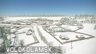
|img=File:MapIcon_Ground_Volokolamsk.jpg | |img=File:MapIcon_Ground_Volokolamsk.jpg | ||
|wiki=Volokolamsk | |wiki=Volokolamsk | ||
| − | |text= ===[[File: | + | |text= ===[[File:CountryIcon_SUN.png|link=|sub]] Volokolamsk=== |
''Location: Volokolamsk, Russia'' | ''Location: Volokolamsk, Russia'' | ||
| Line 425: | Line 442: | ||
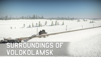
|img=File:MapIcon_Ground_SurroundingsofVolokolamsk.jpg | |img=File:MapIcon_Ground_SurroundingsofVolokolamsk.jpg | ||
|wiki=Surroundings_of_Volokolamsk | |wiki=Surroundings_of_Volokolamsk | ||
| − | |text= ===[[File: | + | |text= ===[[File:CountryIcon_SUN.png|link=|sub]] Surroundings of Volokolamsk=== |
''Location: Volokolamsk, Russia'' | ''Location: Volokolamsk, Russia'' | ||
| Line 435: | Line 452: | ||
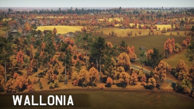
|img=File:MapIcon_Ground_Wallonia.jpg | |img=File:MapIcon_Ground_Wallonia.jpg | ||
|wiki=Wallonia | |wiki=Wallonia | ||
| − | |text= ===[[File: | + | |text= ===[[File:CountryIcon_BEL.png|link=|sub]] Wallonia=== |
''Location: Bastogne, Belgium'' | ''Location: Bastogne, Belgium'' | ||
| Line 445: | Line 462: | ||
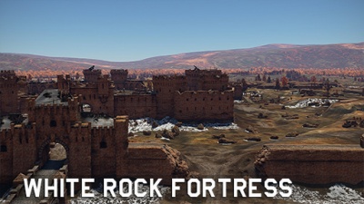
|img=File:MapIcon_Ground_WhiteRockFortress.jpg | |img=File:MapIcon_Ground_WhiteRockFortress.jpg | ||
|wiki=White_Rock_Fortress | |wiki=White_Rock_Fortress | ||
| − | |text= ===[[File: | + | |text= ===[[File:CountryIcon_SUN.png|link=|sub]] White Rock Fortress=== |
''Location: Brest, Belarus'' | ''Location: Brest, Belarus'' | ||
Latest revision as of 17:44, 31 August 2022
|
|
|
|
|
|
|
|
|
|
|
|
|
|
|
|
|
|
|
|
|
|
|
|
|
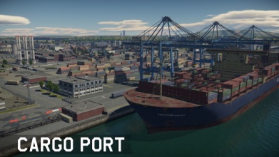
Cargo PortLocation: Fictional Cargo Port is a fictional environment based around a shipment facility. To the north one can find an airfield cut by the long highway. The middle is dominated by buildings while to the south one can find longways separated by containers. |
|
|
|
|
|
|
|
|
|
|
|
|
|
|
|
|
|
|
|
|
|
|
|
|
|
|
|
|
|
|
|
|
|
|
|
|
|
|
|
|
|
|
|
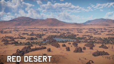
Red Desert |
|
|
|
|
|
|
|
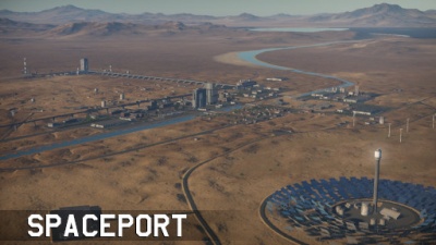
Spaceport |

|
|
|
Sun City |
|
|
|
|
|
|
|
|
|
|
|
|
|
|
|
|
