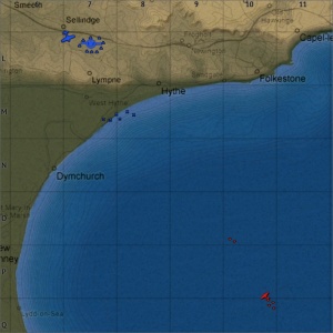
Dover Strait (Air Forces Map)
| Layouts | |||||
|---|---|---|---|---|---|
| Full tank area size | Real world location | ||||
| 4 km x 4 km | |||||
Contents
Overview
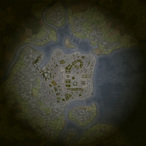
Sweden is a ground forces map available in all modes. It was added to the game in Update 1.97 "Viking Fury". As the name of the map suggests it is set in a Swedish town. The map consists entirely of urban built-up area, although there are some parks and other open spaces which allow for slightly longer range combat; the battle area is littered with barricades and features providing cover, as well as allowing tanks to go "hull-down".
The north and south edges of the map consist of mostly two story residential buildings (some buildings in the north are taller), with wide streets and open parks, there is less hard cover available in these areas compared to other parts of the map. It is in these areas where the spawn points are typically placed.
The eastern edge of the map consists of a long promenade, with little in the way of hard cover. The area to the west of the promenade is mainly city streets with tall (5-6 storey) residential buildings, however there are some open parks and most notably an open area of raised land with a government-looking building and monument on it. A capture point is typically placed here and tanks can use the terrain or various concrete blocks for cover.
The middle area of the map consists of large open gardens with four large government buildings in the centre and a courtyard between them. Again players can use the terrain as well as concrete blocks and other objects for hard cover. A capture point is sometimes placed in the middle of the courtyard between the buildings.
The west of the map is a largely residential area. The buildings here are shorter than in the rest of the map; the streets are fairly wide and there are several open park areas. The west of the map also houses an industrial complex with large factory buildings and storage tanks; where a capture point is sometimes located.
The tank battles map is 4 km x 4 km, but this area is restricted in battles; see the table below for the exact battle area sizes in each mode. The air battles area is 32 km x 32 km.
| Game Mode | AB | RB | SB |
|---|---|---|---|
| Domination | 1.5 km x 1.5 km | 1.5 km x 1.5 km | 1.5 km x 1.5 km |
| Conquest #1 | 1.5 km x 1.5 km | 1.5 km x 1.5 km | 1.5 km x 1.5 km |
| Conquest #2 | 1.5 km x 1.5 km | 1.5 km x 1.5 km | 1.5 km x 1.5 km |
| Conquest #3 | 1.5 km x 1.5 km | 1.5 km x 1.5 km | 1.5 km x 1.5 km |
| Battle | 1.5 km x 1.5 km | 1.5 km x 1.5 km | 1.5 km x 1.5 km |
Historical Background
This map is a fictional location inspired by the Gamla Stan district of Stockholm. Although the design of the map bears resemblance to the real life location there is very little similarity between the layout of the map and that of the real Gamla Stan.
Map configuration
| Change Maps by Game Modes | ||
|---|---|---|
| | ||
At present this map has the same layouts in AB, RB and SB.
Domination
| Domination Mode - Map Layouts |
|---|
|
1.5 km x 1.5 km 1.5 km x 1.5 km 1.5 km x 1.5 km |
|
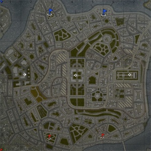
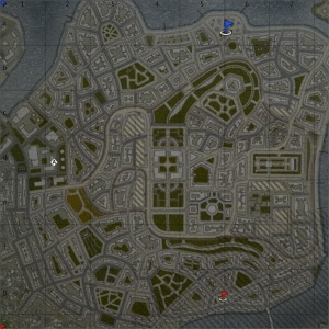
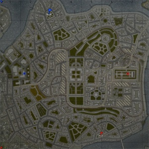
In AB, point A is in the east of the town on the raised area between the government building and the monument, B is in the courtyard between the buildings in the middle of the map, and C is in the industrial complex in the west of the map. In RB, point A is in the east of the town on the raised area between the government building and the monument, B is in the courtyard between the buildings in the middle of the map, and C is in the industrial complex in the west of the map. In SB, point A is in the east of the town on the raised area between the government building and the monument, B is in the courtyard between the buildings in the middle of the map, and C is in the industrial complex in the west of the map. |
Conquest
| Conquest Mode - Map Layouts | ||
|---|---|---|
| Conquest #1 | Conquest #2 | Conquest #3 |
|
1.5 km x 1.5 km 1.5 km x 1.5 km 1.5 km x 1.5 km |
1.5 km x 1.5 km 1.5 km x 1.5 km 1.5 km x 1.5 km |
1.5 km x 1.5 km 1.5 km x 1.5 km 1.5 km x 1.5 km |
|
In AB, the capture point is in the east of the town on the raised area between the government building and the monument. In RB, the capture point is in the east of the town on the raised area between the government building and the monument. In SB, the capture point is in the east of the town on the raised area between the government building and the monument. |
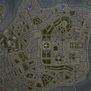
In AB, the capture point is in the courtyard between the buildings in the middle of the map. In RB, the capture paint is in the courtyard between the buildings in the middle of the map. In SB, the capture point is in the courtyard between the buildings in the middle of the map. |
In AB, the capture point is in the industrial complex in the west of the map. In RB, the capture point is in the industrial complex in the west of the map. In SB, the capture point is in the industrial complex in the west of the map. |
Battle
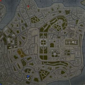
Note: In this layout the northern team get two spawn points, while the southern team only get one.
| Battle Mode - Map Layouts |
|---|
|
1.5 km x 1.5 km 1.5 km x 1.5 km 1.5 km x 1.5 km |
|
In AB, the capture points are located in the east of the town on the raised area between the government building and the monument, and in the industrial complex in the west of the map. In RB, the capture points are located in the east of the town on the raised area between the government building and the monument, and in the industrial complex in the west of the map. In SB, the capture points are located in the east of the town on the raised area between the government building and the monument, and in the industrial complex in the west of the map. |
Strategy
Describe what focus a team should have when spawning into the map
Media
See also
- Similar urban maps
External links
|
Size: 65km x 65km |
Location: Southeast Coast, Britain |
Overview
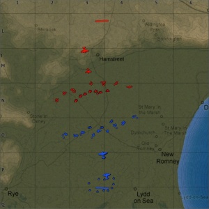
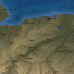
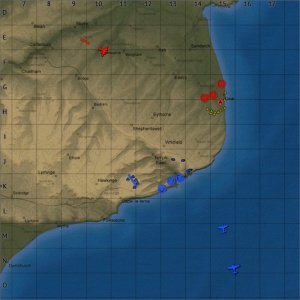
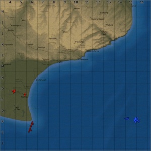
Dover Strait is an air forces map available in Simulator battles; since Update 1.59 "Flaming Arrows" it has been in A Battles by the Dover Strait map. It is based on the southeast coast of England, containing just under half of the county of Kent, the Strait of Dover, and a small part of France (in the southeast corner of the map, usually well outside the playable area). Although the details of the map are not completely accurate in some areas, dimensionally the map is a 1:1 scale recreation of the southeast corner of Britain. The map stretches as far west as the town of Rye in East Sussex, and as north as Queenborough on the Isle of Sheppey.
One of the most prominent landmarks on the map is the Port of Dover, and the surrounding area. The port is a reasonably accurate (although slightly scaled down) recreation of the real life port. Dover Castle has been recreated reasonably accurately on the cliffs to the east of the town, overlooking the port. Further east Swingate transmitting station, one of Britain's "Chain Home" early warning radar installations, used to detect German aircraft crossing the channel; has been recreated (albeit with only three of its original four towers).
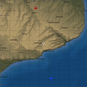
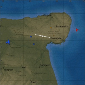
There are a three RAF bases (RAF Manston, RAF Hawkinge, and RAF Lympne) modelled in their real life locations. The largest, RAF Manston, is located in the north of the map on the Isle of Thanet. It is significantly larger than RAF Hawkinge and RAF Lympne, with a single 3,300m paved runway (2,700m in real life), and substantially more hangars and other building on the base. RAF Hawkinge is located 11km west of Dover; it has two grass runways, one 1100m long, the other 800m long. RAF Lympne is located 21km west of Dover, it has two grass runways, one 1100m long (1,300m in real life), the other 700m long; in game the runways are paved, in real life they were grass.
In Update 1.59 "Flaming Arrows" the Dover Strait map was added, it reused England part of this map but was extended east and south (to a size of 128km x 128km), so it include the north of France and more of the channel in the playable area.
Historical Background
The map is set in the southeast of Britain, part of the Battle of Britain was thought of the Summer and Autumn of 1940. Following the Fall of France in June 1940, Britain was left with no allies in Europe. Before the invasion, and even after the fall, of France, Germany had made no planes to invade Britain. Hitler had hoped that following the Fall of France Britain would be prepared to sign a peace agreement on favourable terms, avoiding the need for an invasion. Even when Churchill made Britain's determination to continue fighting clear Hitler still believed Britain would be sign a peace deal, only on July 2nd did he concede an invasion may be necessary and ordered his Generals to consider options for invasion.
An invasion could only be successful if the Royal Navy and the Royal Air Force could be put out of action, giving German supremacy over the English Channel. The German admirals had no confidence that their inferior naval strength could take on the Royal Navy and so insisted that the Luftwaffe (German Air Force) take on the job. Air Marshal Hermann Göring was confident that he could drive the RAF out of the sky and achieve air superiority over the channel in 14 to 28 days, allowing the Luftwaffe to deal with the Royal Navy should they intervene with the invasion. It was agreed that Göring would start a preliminary air offensive, which would not commit the other services to an invasion until mid-September.
The Battle of Britain officially began on 10th July 1940, with German bombing attacks on British shipping convoys (although there had been scattered small scale probing attacks, and reconnaissance since the fall of France on 26th June). This early stage of the battle was known as "Kanalkampf" or "Channel Battle"; it consisted of German dive-bomber attacks on ships in the channel. The Channel Battle continued until the 11 August, the RAF was unable to offer sufficient protection to ships in the channel, and the Royal navy was forced to stop convoys and close the channel to shipping. The RAF also suffered heavy losses at the hand of the Luftwaffe, with 115 fighters lost and another 42 damaged, with 71 pilots killed; the Royal Navy also suffered badly with 35 merchant ships and 4 destroyers sunk. The Luftwaffe lost 80 fighters and over 120 bombers, with 200 airmen killed and 277 missing.
The main assault ("Operation Eagle Attack") began on 13th August 1940, with the aim of completely destroying the RAF. German intelligence reports suggested to Göring that the RAF was almost defeated, and raids would attract the last of the British fighters for the Luftwaffe to shoot down. He planned to destroy Fighter Command in the south of England within four days, and then systematically extend the bombing of military and industrial targets northwards until daylight attacks could proceed unhindered over the whole of Britain. Adlertag ("Eagle Day") was the first day of the assault, consisting of bombing raids on coastal airfields (including Manston and Hawkinge). Over the next week the raids moved further inland. The 18th August 1940 became known as "The Hardest Day" with the Germans launching an all-out assault on the RAF, both sides suffered heavy losses, losing more aircraft than at any other point in the campaign.
At one point a group of German bomber accidentally dropped their bombs on a civilian area of London, prompting the British to launch a retaliatory raid on Berlin on 25 August 1940. In response on the 30th August Hitler withdrew his order to avoid bombing London, and by the 3rd of September Göring was working on plans to bomb London daily. Hitler ordered the bombing of London on the 5th September, and on the 7th the bombing began with a massive series of raids involving nearly 400 bombers and over 600 fighters targeted docks in the East End of London, day and night. This was the start of the Blitz, daily bombing of London day and night. The break from airfield allowed the RAF, which was near the point of collapse to recover.
On the 15th September 1940 the Luftwaffe embarked on an all-out attack against London. With 500 bombers and 620 fighters, in total around 1,500 aircraft took part in the air battles which lasted from the early hours of the evening until dusk. This was the Climax of the Battle of Britain, and became known as Battle of Britain Day. The Germans lost twice as many aircraft as the British, in the aftermath of the battle Hitler postponed Operation Sea Lion and the Luftwaffe turned its attention to night bombing, deeming day bombing to dangerous. From this point onwards, daytime bombing was limited to small fighter bomber raids.
On October 12 Hitler announced the planned invasion of Britain was to be postponed indefinitely and ordered the landing fore to be dispersed. The final daytime bombing raid occurred on 31st October 1941, marking the end of the Battle of Britain. In total the RAF lost 1,542 airmen and 1,742 aircraft; the Luftwaffe suffered 2,585 aircrew killed and another 925 captured, with 1,977 aircraft destroyed. Around 40,000 civilians were killed with another 50,000 wounded.
Layouts
Arcade Battles
[Air Domination] Britain
|
Overview Game Description Historical Background |
[Domination] Britain
|
Overview
Game Description Historical Background |
[Ground Strike] Foggy Albion (light vehicles)
|
Overview
Game Description Historical Background |
[Ground Strike] Two Towns
|
Overview
Game Description Historical Background |
Realistic Battles
[Operation] Britain
|
Overview The number of ground targets changes as the mission progresses. Game Description Historical Background |
Simulator Battles
N/A
Events
[Event] British Convoy
|
Overview
Game Description Historical Background |
[Event] Weapons Test
|
Overview
Game Description Historical Background Britain used a mixture of anti-aircraft guns and fighters aircraft to try and shoot down the bombs before they reached their target; however unlike in this event the bombs were not escorted. |
[Duel] Britain 8x8
|
Overview Game Description Historical Background |
File:MapLayout Duel dover striaght.jpg The Duel layout |
Strategy
Describe what focus a team should have when spawning into the map
Media
Excellent additions to the article would be video guides, screenshots from the game, and photos.
See also
Links to the articles on the War Thunder Wiki that you think will be useful for the reader, for example:
- reference to related locations
External links
Paste links to sources and external resources, such as:
- topic on the official game forum;
- other literature.


