Difference between revisions of "Battle of Hurtgen Forest (Ground Forces)"
Inceptor57 (talk | contribs) (Created page with "{{DISPLAYTITLE:Battle of Hürtgen Forest}} center|408px {| class="catlist" align="center" |- ! ! ! Game Modes ! ! |- |<div...") |
Colok76286 (talk | contribs) (Undo revision 156465 by U137178244 (talk)) |
||
| (8 intermediate revisions by 6 users not shown) | |||
| Line 1: | Line 1: | ||
| − | {{DISPLAYTITLE:Battle of | + | {{DISPLAYTITLE:Battle of Hurtgen Forest (Ground Forces)}} |
| − | |||
| − | |||
| − | |||
| − | |||
| − | |||
| − | |||
| − | |||
| − | |||
| − | |||
| − | |||
| − | |||
| − | |||
| − | |||
| − | |||
| − | |||
| − | |||
| − | |||
| + | <div class="ttx"> | ||
| + | <div class="ttx-image">[[File:MapIcon Ground HurtgenForest.jpg]]</div> | ||
| + | <div class="ttx-table"> | ||
| + | <div class="ttx-table-line ttx-table-head">Possible Layouts</div> | ||
| + | <div class="ttx-table-line"><span class="ttx-value">[[File:Icon GreenCheckmark.png|link=]]</span><span class="ttx-name">Domination</span></div> | ||
| + | <div class="ttx-table-line"><span class="ttx-value">[[File:Icon GreenCheckmark.png|link=]]</span><span class="ttx-name">Conquest</span></div> | ||
| + | <div class="ttx-table-line"><span class="ttx-value">[[File:Icon GreenCheckmark.png|link=]]</span><span class="ttx-name">Battle</span></div> | ||
| + | <div class="ttx-table-line"><span class="ttx-value">[[File:Icon RedXCross.png|link=]]</span><span class="ttx-name">Break</span></div> | ||
| + | <div class="ttx-table-line"><span class="ttx-value">[[File:Icon RedXCross.png|link=]]</span><span class="ttx-name">Skirmish</span></div> | ||
| + | <div class="ttx-table-line ttx-table-head">Other Information</div> | ||
| + | <div class="ttx-table-line"><span class="ttx-value">4 km x 4</span><span class="ttx-name">Full tank area size</span></div> | ||
| + | <div class="ttx-table-line"><span class="ttx-value">Vossenack, Germany [[File:CountryIcon NDE.png]]</span><span class="ttx-name">Real World Location</span></div> | ||
| + | <div class="ttx-table-line ttx-table-head">Full Map</div> | ||
| + | <div class="ttx-image">[[File:MapLayout Ground HurtgenForest.jpg]]</div> | ||
| + | </div> | ||
| + | </div> | ||
| + | |||
__TOC__ | __TOC__ | ||
| − | |||
==Overview== | ==Overview== | ||
| − | + | <!--''Write an introduction to the article in 2-3 small paragraphs. Briefly tell about the location and also about its features.''--> | |
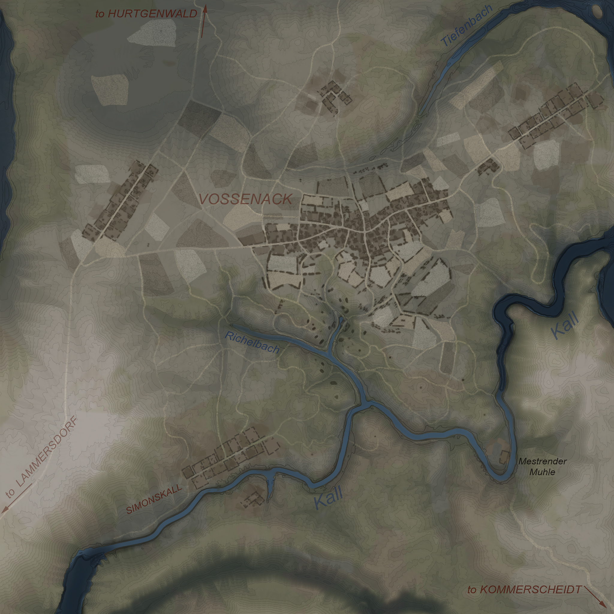
| − | ''' | + | '''Battle of Hürtgen Forest''', also known as '''Hürtgen Forest''', or simply '''Hürtgen''' is a ground forces map available in all modes. It was added in [[Update 1.49 "Weapons of Victory"]]. As the name suggests the map is set in the Hürtgen Forest; a roughly 50 square miles (130 km2) in area in the west of Germany, near the Belgium-Germany border. The map itself is an accurate representation of the town of Vossenack, located in the south-west of the forest. |
The map in game has three main areas; in the middle of the map is the main town of Vossenack. The town has a single road running east to west through it, with small streets branching off of it. The town consists almost entirely of destroyed houses, with only a handful of undamaged buildings. Tanks fight in the streets of the town, and round the back of the buildings, using them for cover. In the center of the town, there is a destroyed church. North of the main town there is a valley, with a large hill on the other side. On the top of the hill there is a small settlement with a windmill and several destroyed buildings. Players on the hill can shoot across the valley to pick off tanks fighting in the north of the town. | The map in game has three main areas; in the middle of the map is the main town of Vossenack. The town has a single road running east to west through it, with small streets branching off of it. The town consists almost entirely of destroyed houses, with only a handful of undamaged buildings. Tanks fight in the streets of the town, and round the back of the buildings, using them for cover. In the center of the town, there is a destroyed church. North of the main town there is a valley, with a large hill on the other side. On the top of the hill there is a small settlement with a windmill and several destroyed buildings. Players on the hill can shoot across the valley to pick off tanks fighting in the north of the town. | ||
| Line 30: | Line 29: | ||
The tank battles map is 4km x 4km (although the battle area can be restricted to less than that) and the air battles are is 64km x 64km. | The tank battles map is 4km x 4km (although the battle area can be restricted to less than that) and the air battles are is 64km x 64km. | ||
| + | |||
| + | {| class="wikitable" | ||
| + | |+ Battle area Size | ||
| + | ! Game Mode | ||
| + | ! AB | ||
| + | ! RB | ||
| + | ! SB | ||
| + | |- | ||
| + | | Domination | ||
| + | | 2.1 km x 2.1 km | ||
| + | | 2.1 km x 2.1 km | ||
| + | | 3.3 km x 3.3 km | ||
| + | |- | ||
| + | | Conquest #1 | ||
| + | | 1.6 km x 1.6 km | ||
| + | | 1.6 km x 1.6 km | ||
| + | | 2.1 km x 2.1 km | ||
| + | |- | ||
| + | | Conquest #2 | ||
| + | | 1.66 km x 1.66 km | ||
| + | | 1.66 km x 1.66 km | ||
| + | | 2.1 km x 2.1 km | ||
| + | |- | ||
| + | | Conquest #3 | ||
| + | | 1.6 km x 1.6 km | ||
| + | | 1.6 km x 1.6 km | ||
| + | | 2.1 km x 2.1 km | ||
| + | |- | ||
| + | | Conquest #4 | ||
| + | | 1.6 km x 1.6 km | ||
| + | | 1.6 km x 1.6 km | ||
| + | | 2.1 km x 2.1 km | ||
| + | |- | ||
| + | | Battle | ||
| + | | 1.7 km x 1.7 km | ||
| + | | 1.7 km x 1.7 km | ||
| + | | 3.4 km x 3.4 km | ||
| + | |} | ||
===Game Description=== | ===Game Description=== | ||
| + | <!--Description in the map loading screen prior to joining the battle. Remove if non-existent.--> | ||
Teams fight for control over a strategically important point located in Hürtgen Forest. | Teams fight for control over a strategically important point located in Hürtgen Forest. | ||
===Historical Background=== | ===Historical Background=== | ||
| + | <!--''Describe historical context of the location.''--> | ||
The Battle of Hürtgen Forest was a series of fierce battles fought from 19 September to 16 December 1944 between American and German forces, it was the longest battle on German ground during World War II, and is the longest single battle the U.S. Army has ever fought. The American Forces hoped to pin down German forces in the area to keep them from reinforcing the front lines farther north in the Battle of Aachen; and later advance from the forest, and down the Ruhr river. The Germans fiercely defended the area because it served as a staging area for the planned counter attack in the Ardennes. Ultimately the Allies failed to capture the area after suffering several heavy setbacks and German forces were able to successfully hold the region until they launched their counter-attack through the Ardennes (which became known as the Battle of the Bulge), ending the Hürtgen offensive. The Allies suffered over 33,000 casualties during the failed attack and the Germans suffered 28,000 in the defense. Following the failed German counter attack in the Ardennes, in early February 1945 American forces attacked through the Hürtgen Forest again; breaking through the severely weakened German defense and advancing into the Ruhr valley. | The Battle of Hürtgen Forest was a series of fierce battles fought from 19 September to 16 December 1944 between American and German forces, it was the longest battle on German ground during World War II, and is the longest single battle the U.S. Army has ever fought. The American Forces hoped to pin down German forces in the area to keep them from reinforcing the front lines farther north in the Battle of Aachen; and later advance from the forest, and down the Ruhr river. The Germans fiercely defended the area because it served as a staging area for the planned counter attack in the Ardennes. Ultimately the Allies failed to capture the area after suffering several heavy setbacks and German forces were able to successfully hold the region until they launched their counter-attack through the Ardennes (which became known as the Battle of the Bulge), ending the Hürtgen offensive. The Allies suffered over 33,000 casualties during the failed attack and the Germans suffered 28,000 in the defense. Following the failed German counter attack in the Ardennes, in early February 1945 American forces attacked through the Hürtgen Forest again; breaking through the severely weakened German defense and advancing into the Ruhr valley. | ||
In the in-game map the church in the town is largely destroyed, in real life this was the result of a group of M4 Sherman tanks firing into the Church to kill snipers believed to be hiding in the church's Belfry. | In the in-game map the church in the town is largely destroyed, in real life this was the result of a group of M4 Sherman tanks firing into the Church to kill snipers believed to be hiding in the church's Belfry. | ||
| − | |||
| − | |||
==Map configuration== | ==Map configuration== | ||
| − | ===Game Modes=== | + | <!--Under this heading is the box to change game mode--> |
| − | + | {| class="wikitable" style="width:314; margin-left: auto; margin-right: auto; border: none;" | |
| − | + | ! colspan="3" | Change Maps by Game Modes | |
| + | |- | ||
| + | ! <div class="ttx-switch-mode"><div class="ttx-switch-mode-button" id="ttx-ab-button">AB</div><div class="ttx-switch-mode-button" id="ttx-rb-button">RB</div><div class="ttx-switch-mode-button" id="ttx-sb-button">SB</div></div> | ||
| + | |} | ||
| − | + | ===Domination=== | |
| − | + | <!--Put map screenshot, layout sizes and basic description (where each cap point is) in table using ttx-ab, ttx-rb &ttx-sb spans appropriately. If a more detailed description is desired then insert it as a paragraph of text above the table--> | |
| − | |||
| − | |||
| − | |||
| − | |||
| − | + | {| class="wikitable" style="width: 300px;" | |
| − | + | ! Domination Mode - Map Layouts | |
| − | [[File:MapLayout | + | |- align="center" |
| + | | | ||
| + | <div style="float: none;" class="ttx-ab">[[File:MapLayout Domination HurtgenForest ABRB.jpg|300px]]</div> | ||
| + | <div style="float: none;" class="ttx-rb">[[File:MapLayout Domination HurtgenForest ABRB.jpg|300px]]</div> | ||
| + | <div style="float: none;" class="ttx-sb">[[File:MapLayout Domination HurtgenForest SB.jpg|300px]]</div> | ||
| + | |- align="center" | ||
| + | | | ||
| + | <span class="ttx-ab">2.1 km x 2.1</span> | ||
| + | <span class="ttx-rb">2.1 km x 2.1</span> | ||
| + | <span class="ttx-sb">3.3 km x 3.3 km</span> | ||
| + | |- | ||
| + | | | ||
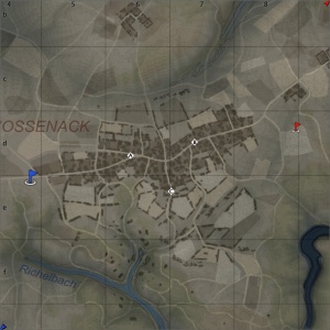
| + | <span class="ttx-ab">In AB point A is on the western portion of the town, B is on the eastern portion of the town, and C is in south of the town.</span> | ||
| + | <span class="ttx-rb">In RB point A is on the western portion of the town, B is on the eastern portion of the town, and C is in south of the town.</span> | ||
| + | <span class="ttx-sb">In SB point A is on the western portion of the town, B is on the eastern portion of the town, and C is in settlement on the north hill.</span> | ||
| + | |} | ||
| + | |||
| + | ===Conquest=== | ||
| + | <!--Put map screenshot, layout sizes and basic description (where each cap point is) in table using ttx-ab, ttx-rb &ttx-sb spans appropriately. If a more detailed description is desired then insert it as a paragraph of text above the table--> | ||
| + | With the conquest layouts the capture point is in the same place in AB, RB and SB. However in Sb the battle area is much bigger and the spawn points are further away. | ||
| + | {| class="wikitable" style="width: 900px;" | ||
| + | ! colspan="4" | Conquest Mode - Map Layouts | ||
| + | |- | ||
| + | ! Conquest #1 | ||
| + | ! Conquest #2 | ||
| + | ! Conquest #3 | ||
| + | ! Conquest #4 | ||
| + | |- align="center" | ||
| + | | | ||
| + | <div style="float: none;" class="ttx-ab">[[File:MapLayout Conquest1 HurtgenForest ABRB.jpg|300px]]</div> | ||
| + | <div style="float: none;" class="ttx-rb">[[File:MapLayout Conquest1 HurtgenForest ABRB.jpg|300px]]</div> | ||
| + | <div style="float: none;" class="ttx-sb">[[File:MapLayout Conquest1 HurtgenForest SB.jpg|300px]]</div> | ||
| + | | | ||
| + | <div style="float: none;" class="ttx-ab">[[File:MapLayout Conquest2 HurtgenForest ABRB.jpg|300px]]</div> | ||
| + | <div style="float: none;" class="ttx-rb">[[File:MapLayout Conquest2 HurtgenForest ABRB.jpg|300px]]</div> | ||
| + | <div style="float: none;" class="ttx-sb">[[File:MapLayout Conquest2 HurtgenForest SB.jpg|300px]]</div> | ||
| + | | | ||
| + | <div style="float: none;" class="ttx-ab">[[File:MapLayout Conquest3 HurtgenForest ABRB.jpg|300px]]</div> | ||
| + | <div style="float: none;" class="ttx-rb">[[File:MapLayout Conquest3 HurtgenForest ABRB.jpg|300px]]</div> | ||
| + | <div style="float: none;" class="ttx-sb">[[File:MapLayout Conquest3 HurtgenForest SB.jpg|300px]]</div> | ||
| + | | | ||
| + | <div style="float: none;" class="ttx-ab">[[File:MapLayout Conquest4 HurtgenForest ABRB.jpg|300px]]</div> | ||
| + | <div style="float: none;" class="ttx-rb">[[File:MapLayout Conquest4 HurtgenForest ABRB.jpg|300px]]</div> | ||
| + | <div style="float: none;" class="ttx-sb">[[File:MapLayout Conquest4 HurtgenForest SB.jpg|300px]]</div> | ||
| + | |- align="center" | ||
| + | | | ||
| + | <span class="ttx-ab">1.6 km x 1.6</span> | ||
| + | <span class="ttx-rb">1.6 km x 1.6</span> | ||
| + | <span class="ttx-sb">2.1 km x 2.1</span> | ||
| + | | | ||
| + | <span class="ttx-ab">1.66 km x 1.66</span> | ||
| + | <span class="ttx-rb">1.66 km x 1.66</span> | ||
| + | <span class="ttx-sb">2.1 km x 2.1</span> | ||
| + | | | ||
| + | <span class="ttx-ab">1.6 km x 1.6</span> | ||
| + | <span class="ttx-rb">1.6 km x 1.6</span> | ||
| + | <span class="ttx-sb">2.1 km x 2.1</span> | ||
| + | | | ||
| + | <span class="ttx-ab">1.6 km x 1.6</span> | ||
| + | <span class="ttx-rb">1.6 km x 1.6</span> | ||
| + | <span class="ttx-sb">2.1 km x 2.1</span> | ||
| + | |- | ||
| + | | | ||
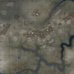
| + | <span class="ttx-ab">In AB capture point is in the gorge, in the south.</span> | ||
| + | <span class="ttx-rb">In RB capture point is in the gorge, in the south.</span> | ||
| + | <span class="ttx-sb">In SB capture point is in the gorge, in the south.</span> | ||
| + | | | ||
| + | <span class="ttx-ab">In AB the capture point is next to the church, at the main cross roads in the town.</span> | ||
| + | <span class="ttx-rb">In RB the capture point is next to the church, at the main cross roads in the town.</span> | ||
| + | <span class="ttx-sb">In SB the capture point is next to the church, at the main cross roads in the town.</span> | ||
| + | | | ||
| + | <span class="ttx-ab">In AB the capture point is in the small settlement on top of the north hill.</span> | ||
| + | <span class="ttx-rb">In RB the capture point is in the small settlement on top of the north hill.</span> | ||
| + | <span class="ttx-sb">In SB the capture point is in the small settlement on top of the north hill.</span> | ||
| + | | | ||
| + | <span class="ttx-ab">In AB the capture point is at a fork in the river Kall, in the south of the map.</span> | ||
| + | <span class="ttx-rb">In RB the capture point is at a fork in the river Kall, in the south of the map.</span> | ||
| + | <span class="ttx-sb">In SB the capture point is at a fork in the river Kall, in the south of the map.</span> | ||
| + | |} | ||
| + | |||
| + | ===Battle=== | ||
| + | <!--Put map screenshots, layout sizes and basic descriptions (where each cap point is) in table using ttx-ab, ttx-rb &ttx-sb spans appropriately. If a more detailed description is desired then insert it as a paragraph of text above the table--> | ||
| + | The capture points are in the same place in AB, RB and SB. However in SB the battle area is much bigger and the spawns are further away. | ||
| + | {| class="wikitable" style="width: 300px;" | ||
| + | ! Battle Mode - Map Layouts | ||
| + | |- align="center" | ||
| + | | | ||
| + | <div style="float: none;" class="ttx-ab">[[File:MapLayout Battle HurtgenForest ABRB.jpg|300px]]</div> | ||
| + | <div style="float: none;" class="ttx-rb">[[File:MapLayout Battle HurtgenForest ABRB.jpg|300px]]</div> | ||
| + | <div style="float: none;" class="ttx-sb">[[File:MapLayout Battle HurtgenForest SB.jpg|300px]]</div> | ||
| + | |- align="center" | ||
| + | | | ||
| + | <span class="ttx-ab">1.7 km x 1.7 km</span> | ||
| + | <span class="ttx-rb">1.7 km x 1.7 km</span> | ||
| + | <span class="ttx-sb">3.4 km x 3.4 km</span> | ||
| + | |- | ||
| + | | | ||
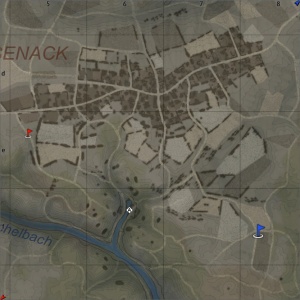
| + | <span class="ttx-ab">In AB the point A is in the west of the town, and point B is in the east of the town.</span> | ||
| + | <span class="ttx-rb">In RB the point A is in the west of the town, and point B is in the east of the town.</span> | ||
| + | <span class="ttx-sb">In SB the point A is in the west of the town, and point B is in the east of the town.</span> | ||
| + | |} | ||
==Strategy== | ==Strategy== | ||
| + | ''Describe what focus a team should have when spawning into the map'' | ||
== Media == | == Media == | ||
| − | <!-- | + | <!--Excellent additions to the article would be video guides, screenshots from the game, and photos.--> |
| − | {{ | + | {{Youtube-gallery|L04Bp-FkBhA|'''The Shooting Range #4''' - ''Map Guide'' section at 07:36 discusses the map Battle of Hürtgen Forest.}} |
==References== | ==References== | ||
<references /> | <references /> | ||
| − | == | + | == See also == |
<!--''Links to the articles on the War Thunder Wiki that you think will be useful for the reader, for example,'' | <!--''Links to the articles on the War Thunder Wiki that you think will be useful for the reader, for example,'' | ||
* ''reference to the series of the vehicles;'' | * ''reference to the series of the vehicles;'' | ||
* ''links to approximate analogues of other nations and research trees.'' | * ''links to approximate analogues of other nations and research trees.'' | ||
''ETC.''--> | ''ETC.''--> | ||
| − | |||
| − | == | + | * [[Berlin (Ground Forces)]] (Another historically accurate tank map added in [[Update 1.49]]) |
| − | ''Paste links to sources and external resources, such as:'' | + | |
| + | == External links == | ||
| + | <!--''Paste links to sources and external resources, such as:'' | ||
* ''topic on the official game forum;'' | * ''topic on the official game forum;'' | ||
| − | * ''other literature.'' | + | * ''encyclopedia page on location/battle;'' |
| + | * ''other literature.''--> | ||
| + | |||
| + | * [https://warthunder.com/en/devblog/current/759 [Devblog<nowiki>]</nowiki> Battle of Hurtgen Forest] | ||
[[Category:Maps_and_missions]] | [[Category:Maps_and_missions]] | ||
[[Category:Ground forces maps]] | [[Category:Ground forces maps]] | ||
Latest revision as of 17:34, 27 February 2023
Contents
Overview
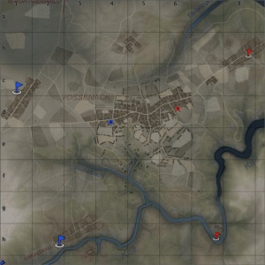
Battle of Hürtgen Forest, also known as Hürtgen Forest, or simply Hürtgen is a ground forces map available in all modes. It was added in Update 1.49 "Weapons of Victory". As the name suggests the map is set in the Hürtgen Forest; a roughly 50 square miles (130 km2) in area in the west of Germany, near the Belgium-Germany border. The map itself is an accurate representation of the town of Vossenack, located in the south-west of the forest.
The map in game has three main areas; in the middle of the map is the main town of Vossenack. The town has a single road running east to west through it, with small streets branching off of it. The town consists almost entirely of destroyed houses, with only a handful of undamaged buildings. Tanks fight in the streets of the town, and round the back of the buildings, using them for cover. In the center of the town, there is a destroyed church. North of the main town there is a valley, with a large hill on the other side. On the top of the hill there is a small settlement with a windmill and several destroyed buildings. Players on the hill can shoot across the valley to pick off tanks fighting in the north of the town.
South of the town the terrain becomes more hilly. There is a small gorge, with rocky cliffs on each side, and the river Kall to the south. Teams trade shots from the cliffs on each side of the gorge, with some tanks venturing down the paths into the gorge; either to capture a the point that is sometimes located there, or to advance up to the other team's side of the gorge and engage them on the cliffs. Players can flank the enemy team by advancing around the north gorge, through the south of the town, and engaging them from the side. Alternatively tanks can go south, either following the river into the gorge, or use the southern river bank to flank the enemy tanks on the cliffs. The area to the south o the river Kall is extremely hilly and densely forested, with steep paths and concrete fortifications.
The tank battles map is 4km x 4km (although the battle area can be restricted to less than that) and the air battles are is 64km x 64km.
| Game Mode | AB | RB | SB |
|---|---|---|---|
| Domination | 2.1 km x 2.1 km | 2.1 km x 2.1 km | 3.3 km x 3.3 km |
| Conquest #1 | 1.6 km x 1.6 km | 1.6 km x 1.6 km | 2.1 km x 2.1 km |
| Conquest #2 | 1.66 km x 1.66 km | 1.66 km x 1.66 km | 2.1 km x 2.1 km |
| Conquest #3 | 1.6 km x 1.6 km | 1.6 km x 1.6 km | 2.1 km x 2.1 km |
| Conquest #4 | 1.6 km x 1.6 km | 1.6 km x 1.6 km | 2.1 km x 2.1 km |
| Battle | 1.7 km x 1.7 km | 1.7 km x 1.7 km | 3.4 km x 3.4 km |
Game Description
Teams fight for control over a strategically important point located in Hürtgen Forest.
Historical Background
The Battle of Hürtgen Forest was a series of fierce battles fought from 19 September to 16 December 1944 between American and German forces, it was the longest battle on German ground during World War II, and is the longest single battle the U.S. Army has ever fought. The American Forces hoped to pin down German forces in the area to keep them from reinforcing the front lines farther north in the Battle of Aachen; and later advance from the forest, and down the Ruhr river. The Germans fiercely defended the area because it served as a staging area for the planned counter attack in the Ardennes. Ultimately the Allies failed to capture the area after suffering several heavy setbacks and German forces were able to successfully hold the region until they launched their counter-attack through the Ardennes (which became known as the Battle of the Bulge), ending the Hürtgen offensive. The Allies suffered over 33,000 casualties during the failed attack and the Germans suffered 28,000 in the defense. Following the failed German counter attack in the Ardennes, in early February 1945 American forces attacked through the Hürtgen Forest again; breaking through the severely weakened German defense and advancing into the Ruhr valley.
In the in-game map the church in the town is largely destroyed, in real life this was the result of a group of M4 Sherman tanks firing into the Church to kill snipers believed to be hiding in the church's Belfry.
Map configuration
| Change Maps by Game Modes | ||
|---|---|---|
| | ||
Domination
| Domination Mode - Map Layouts |
|---|
|
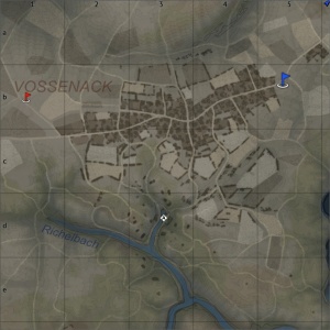
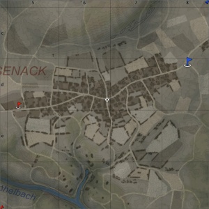
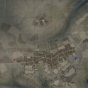
2.1 km x 2.1 2.1 km x 2.1 3.3 km x 3.3 km |
|
In AB point A is on the western portion of the town, B is on the eastern portion of the town, and C is in south of the town. In RB point A is on the western portion of the town, B is on the eastern portion of the town, and C is in south of the town. In SB point A is on the western portion of the town, B is on the eastern portion of the town, and C is in settlement on the north hill. |
Conquest
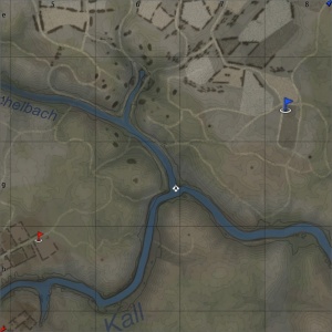
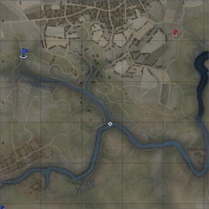
With the conquest layouts the capture point is in the same place in AB, RB and SB. However in Sb the battle area is much bigger and the spawn points are further away.
| Conquest Mode - Map Layouts | |||
|---|---|---|---|
| Conquest #1 | Conquest #2 | Conquest #3 | Conquest #4 |
|
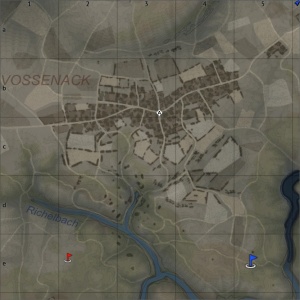
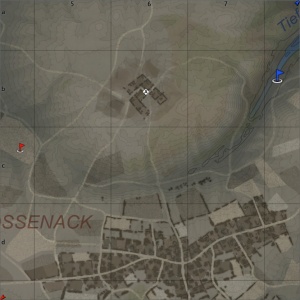
1.6 km x 1.6 1.6 km x 1.6 2.1 km x 2.1 |
1.66 km x 1.66 1.66 km x 1.66 2.1 km x 2.1 |
1.6 km x 1.6 1.6 km x 1.6 2.1 km x 2.1 |
1.6 km x 1.6 1.6 km x 1.6 2.1 km x 2.1 |
|
In AB capture point is in the gorge, in the south. In RB capture point is in the gorge, in the south. In SB capture point is in the gorge, in the south. |
In AB the capture point is next to the church, at the main cross roads in the town. In RB the capture point is next to the church, at the main cross roads in the town. In SB the capture point is next to the church, at the main cross roads in the town. |
In AB the capture point is in the small settlement on top of the north hill. In RB the capture point is in the small settlement on top of the north hill. In SB the capture point is in the small settlement on top of the north hill. |
In AB the capture point is at a fork in the river Kall, in the south of the map. In RB the capture point is at a fork in the river Kall, in the south of the map. In SB the capture point is at a fork in the river Kall, in the south of the map. |
Battle
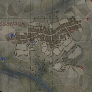
The capture points are in the same place in AB, RB and SB. However in SB the battle area is much bigger and the spawns are further away.
| Battle Mode - Map Layouts |
|---|
|
1.7 km x 1.7 km 1.7 km x 1.7 km 3.4 km x 3.4 km |
|
In AB the point A is in the west of the town, and point B is in the east of the town. In RB the point A is in the west of the town, and point B is in the east of the town. In SB the point A is in the west of the town, and point B is in the east of the town. |
Strategy
Describe what focus a team should have when spawning into the map
Media
References
See also
- Berlin (Ground Forces) (Another historically accurate tank map added in Update 1.49)


