Difference between revisions of "American Desert"
Inceptor57 (talk | contribs) (Created page with "{{DISPLAYTITLE:American Desert}} <div class="object-info clearfix" align="justify"> <div class="right-area"> File:MapIcon Ground AmericanDesert.jpg|center|408px|link...") |
Colok76286 (talk | contribs) (→Media: Added Shooting Range episode) |
||
| (6 intermediate revisions by 5 users not shown) | |||
| Line 1: | Line 1: | ||
{{DISPLAYTITLE:American Desert}} | {{DISPLAYTITLE:American Desert}} | ||
| − | <div class=" | + | <div class="ttx"> |
| − | <div class=" | + | <div class="ttx-image">[[File:MapIcon Ground AmericanDesert.jpg]] |
| − | + | <div class="ttx-cockpit" data-id="303119/973174/"><span>Preview</span></div></div> | |
| + | <div class="ttx-table"> | ||
| + | <div class="ttx-table-line ttx-table-head">Possible Layouts</div> | ||
| + | <div class="ttx-table-line"><span class="ttx-value">[[File:Icon GreenCheckmark.png|link=]]</span><span class="ttx-name">Domination</span></div> | ||
| + | <div class="ttx-table-line"><span class="ttx-value">[[File:Icon GreenCheckmark.png|link=]]</span><span class="ttx-name">Conquest</span></div> | ||
| + | <div class="ttx-table-line"><span class="ttx-value">[[File:Icon GreenCheckmark.png|link=]]</span><span class="ttx-name">Battle</span></div> | ||
| + | <div class="ttx-table-line"><span class="ttx-value">[[File:Icon RedXCross.png|link=]]</span><span class="ttx-name">Break</span></div> | ||
| + | <div class="ttx-table-line"><span class="ttx-value">[[File:Icon RedXCross.png|link=]]</span><span class="ttx-name">Skirmish</span></div> | ||
| + | <div class="ttx-table-line ttx-table-head">Other Information</div> | ||
| + | <div class="ttx-table-line"><span class="ttx-value">4 km x 4 km</span><span class="ttx-name">Full tank area size</span></div> | ||
| + | <div class="ttx-table-line"><span class="ttx-value">Arizona, USA [[File:CountryIcon USA.png]]</span><span class="ttx-name">Real World Location</span></div> | ||
| + | <div class="ttx-table-line ttx-table-head">Full Map</div> | ||
| + | <div class="ttx-image">[[File:MapLayout_Ground_AmericanDesert.jpg]]</div> | ||
| + | </div> | ||
| + | </div> | ||
| − | |||
| − | |||
| − | |||
| − | |||
| − | |||
| − | |||
| − | |||
| − | |||
| − | |||
| − | |||
| − | |||
| − | |||
| − | |||
| − | |||
| − | |||
__TOC__ | __TOC__ | ||
==Overview== | ==Overview== | ||
| − | + | <!--''Write an introduction to the article in 2-3 small paragraphs. Briefly tell about the location and also about its features.''--> | |
| − | '''American Desert''' is a ground forces map available in all modes. It was added in [[Update 1.81 "The Valkyries"]]. The map is set in 1950s America, specifically the deserts of Arizona. The map consists of a small town (approximately 1km x 1km), and the surrounding desert. To the west of the town there is a large lake with a small neighbourhood on its southern bank and | + | '''American Desert''' is a ground forces map available in all modes. It was added in [[Update 1.81 "The Valkyries"]]. In [[Update 1.87 "Locked On"]] the map was updated so that nearly all buildings are destructible. The map is set in 1950s America, specifically the deserts of Arizona. The map consists of a small town (approximately 1km x 1km), and the surrounding desert. To the west of the town there is a large lake with a small neighbourhood on its southern bank and to the east of the town there is a smaller lake. To the south of the town there are some small mesas, while the area to the north of the town consists of more open desert. Currently all layouts of the map, available in normal matches, limit the battle area to just the town and a small amount of the surrounding area. A unique feature of the map is an animated train which makes its way from the south of the map along a railway line, running past the west of the town. Players can destroy the train and the train can collide with players, with both situations often leading to the train derailing. |
| − | The town itself is made up mostly of one and two story residential and commercial buildings, with a few three story | + | The town itself is made up mostly of one and two story residential and commercial buildings, with a few three story buildings; it is made up of a few distinct areas. The south of the town is fairly open with some rocks helping to break up the area; it consists mostly of low density residential buildings, with a dilapidated fuel station in the south eastern corner of the town. The middle and northwest of the town is made up mostly of larger commercial buildings, with the west being taken up by a train station, one train is static and stopped at the platform, the moving train will pass through the station a few minutes into the battle. In the centre of the town there is a roundabout with a large statue in the middle of it. The eastern flank of the town, much like the south; consists mostly of low density, single story, residential buildings some of which have grass lawns while others have sand. There is also a large car park on the eastern edge of the town. The northeast of the town consists of a mix of residential and commercial buildings, more densely packed than in the south and east. |
Across the railway track, west of the town, there is a large lake with a small neighbourhood built up along its southeast bank, the banks of the lake a significantly lower than the surrounding terrain. To the south of the lake there is a tall hill; terrain to the south of the hill consists of uneven open desert. To the north of the lake the railway banks round to the west, leaving the map in the northwest, north of the railway the terrain becomes extremely uneven with many tall sand dunes. | Across the railway track, west of the town, there is a large lake with a small neighbourhood built up along its southeast bank, the banks of the lake a significantly lower than the surrounding terrain. To the south of the lake there is a tall hill; terrain to the south of the hill consists of uneven open desert. To the north of the lake the railway banks round to the west, leaving the map in the northwest, north of the railway the terrain becomes extremely uneven with many tall sand dunes. | ||
| Line 31: | Line 30: | ||
South / southeast of the town there are three tall mesas; the terrain between them is very uneven, being somewhat of a valley with numerous small hills and dips in the terrain; a number of dirt tracks cut through this area. To the east of the town there is a smaller lake with another small community built up on its eastern bank. Further east from the town the terrain turns into open desert, meanwhile to the north there is a tall hill with a radio tower and derelict hut at its peak. The area north of the lake is again largely open desert, but the terrain is much flatter than in other areas of the map, the terrain elevation is also notably lower than that of the main town. In the far northeast of the map there is a small rural settlement. | South / southeast of the town there are three tall mesas; the terrain between them is very uneven, being somewhat of a valley with numerous small hills and dips in the terrain; a number of dirt tracks cut through this area. To the east of the town there is a smaller lake with another small community built up on its eastern bank. Further east from the town the terrain turns into open desert, meanwhile to the north there is a tall hill with a radio tower and derelict hut at its peak. The area north of the lake is again largely open desert, but the terrain is much flatter than in other areas of the map, the terrain elevation is also notably lower than that of the main town. In the far northeast of the map there is a small rural settlement. | ||
| − | The full tank battles map is 4km x 4km, see the table below for the restricted size available in each game mode. The air battles map is 65km x 65km. | + | The full tank battles map is 4km x 4km, however this is usually restricted to just the main town, see the table below for the restricted size available in each game mode. The air battles map is 65km x 65km. |
{| class="wikitable" | {| class="wikitable" | ||
| Line 67: | Line 66: | ||
===Historical Background=== | ===Historical Background=== | ||
| + | <!--''Describe historical context of the location.''--> | ||
The map is a fictional location set in the deserts in the southwest of the United States, the buildings and visual style of the map were inspired by the city of Page, Arizona, however the layout of the map bears little resemblance to the real location. | The map is a fictional location set in the deserts in the southwest of the United States, the buildings and visual style of the map were inspired by the city of Page, Arizona, however the layout of the map bears little resemblance to the real location. | ||
==Map configuration== | ==Map configuration== | ||
| − | + | <!--Under this heading is the box to change game mode--> | |
| − | + | {| style="width:314; margin-left: auto; margin-right: auto; border: none;" class="wikitable" | |
| − | + | ! colspan="3" | Change Maps by Game Modes | |
| + | |- | ||
| + | ! <div class="ttx-switch-mode"><div class="ttx-switch-mode-button" id="ttx-ab-button">AB</div><div class="ttx-switch-mode-button" id="ttx-rb-button">RB</div><div class="ttx-switch-mode-button" id="ttx-sb-button" >SB</div></div> | ||
| + | |} | ||
| + | |||
| + | At present this map has the same layouts in AB, RB and SB. | ||
| − | + | ===Domination=== | |
| − | + | <!--Put map screenshot, layout sizes and basic description (where each cap point is) in table using ttx-ab, ttx-rb &ttx-sb spans appropriately. If a more detailed description is desired then insert it as a paragraph of text above the table--> | |
| − | |||
| − | |||
| − | |||
| − | + | There are three capture points. Point A is at the train station in the west of the town, B is at the roundabout in the centre of the town, and C is at a church among the residential buildings in the northeast of the town. | |
| − | + | ||
| − | + | {| style="width: 300px;" class="wikitable" | |
| + | ! Domination Mode - Map Layouts | ||
| + | |- align="center" | ||
| + | | | ||
| + | <div style="float: none;" class="ttx-ab">[[File:MapLayout Domination AmericanDesert ABRBSB.jpg|300px]]</div> | ||
| + | <div style="float: none;" class="ttx-rb">[[File:MapLayout Domination AmericanDesert ABRBSB.jpg|300px]]</div> | ||
| + | <div style="float: none;" class="ttx-sb">[[File:MapLayout Domination AmericanDesert ABRBSB.jpg|300px]]</div> | ||
| + | |- align="center" | ||
| + | | | ||
| + | <span class="ttx-ab">1.35 km x 1.35 km</span> | ||
| + | <span class="ttx-rb">1.35 km x 1.35 km</span> | ||
| + | <span class="ttx-sb">1.35 km x 1.35 km</span> | ||
| + | |- | ||
| + | | | ||
| + | <span class="ttx-ab">In AB point A is at the train station in the west of the town, B is at the roundabout in the centre of the town, and C is at a church among the residential buildings in the northeast of the town.</span> | ||
| + | <span class="ttx-rb">In RB point A is at the train station in the west of the town, B is at the roundabout in the centre of the town, and C is at a church among the residential buildings in the northeast of the town.</span> | ||
| + | <span class="ttx-sb">In SB point A is at the train station in the west of the town, B is at the roundabout in the centre of the town, and C is at a church among the residential buildings in the northeast of the town.</span> | ||
| + | |} | ||
| + | |||
| + | ===Conquest=== | ||
| + | <!--Put map screenshots, layout sizes and basic descriptions (where each cap point is) in table using ttx-ab, ttx-rb &ttx-sb spans appropriately. If a more detailed description is desired then insert it as a paragraph of text above the table--> | ||
| + | |||
| + | {| style="width: 900px;" class="wikitable" | ||
| + | ! colspan="3" | Conquest Mode - Map Layouts | ||
| + | |- | ||
| + | ! Conquest #1 | ||
| + | ! Conquest #2 | ||
| + | ! Conquest #3 | ||
| + | |- align="center" | ||
| + | | | ||
| + | <div style="float: none;" class="ttx-ab">[[File:MapLayout Conquest1 AmericanDesert ABRBSB.jpg|300px]]</div> | ||
| + | <div style="float: none;" class="ttx-rb">[[File:MapLayout Conquest1 AmericanDesert ABRBSB.jpg|300px]]</div> | ||
| + | <div style="float: none;" class="ttx-sb">[[File:MapLayout Conquest1 AmericanDesert ABRBSB.jpg|300px]]</div> | ||
| + | | | ||
| + | <div style="float: none;" class="ttx-ab">[[File:MapLayout Conquest2 AmericanDesert ABRBSB.jpg|300px]]</div> | ||
| + | <div style="float: none;" class="ttx-rb">[[File:MapLayout Conquest2 AmericanDesert ABRBSB.jpg|300px]]</div> | ||
| + | <div style="float: none;" class="ttx-sb">[[File:MapLayout Conquest2 AmericanDesert ABRBSB.jpg|300px]]</div> | ||
| + | | | ||
| + | <div style="float: none;" class="ttx-ab">[[File:MapLayout Conquest3 AmericanDesert ABRBSB.jpg|300px]]</div> | ||
| + | <div style="float: none;" class="ttx-rb">[[File:MapLayout Conquest3 AmericanDesert ABRBSB.jpg|300px]]</div> | ||
| + | <div style="float: none;" class="ttx-sb">[[File:MapLayout Conquest3 AmericanDesert ABRBSB.jpg|300px]]</div> | ||
| + | |- align="center" | ||
| + | | | ||
| + | <span class="ttx-ab">1.35 km x 1.35 km</span> | ||
| + | <span class="ttx-rb">1.35 km x 1.35 km</span> | ||
| + | <span class="ttx-sb">1.35 km x 1.35 km</span> | ||
| + | | | ||
| + | <span class="ttx-ab">1.35 km x 1.35 km</span> | ||
| + | <span class="ttx-rb">1.35 km x 1.35 km</span> | ||
| + | <span class="ttx-sb">1.35 km x 1.35 km</span> | ||
| + | | | ||
| + | <span class="ttx-ab">1.35 km x 1.35 km</span> | ||
| + | <span class="ttx-rb">1.35 km x 1.35 km</span> | ||
| + | <span class="ttx-sb">1.35 km x 1.35 km</span> | ||
| + | |- | ||
| + | | | ||
| + | <span class="ttx-ab">In AB the capture point is at the train station in the west of the town.</span> | ||
| + | <span class="ttx-rb">In RB the capture point is at the train station in the west of the town.</span> | ||
| + | <span class="ttx-sb">In SB the capture point is at the train station in the west of the town.</span> | ||
| + | | | ||
| + | <span class="ttx-ab">In AB the capture point is at the roundabout in the centre of the town.</span> | ||
| + | <span class="ttx-rb">In RB the capture point is at the roundabout in the centre of the town.</span> | ||
| + | <span class="ttx-sb">In SB the capture point is at the roundabout in the centre of the town.</span> | ||
| + | | | ||
| + | <span class="ttx-ab">In AB the capture point is at a church among the residential buildings in the northeast of the town.</span> | ||
| + | <span class="ttx-rb">In RB the capture point is at a church among the residential buildings in the northeast of the town.</span> | ||
| + | <span class="ttx-sb">In SB the capture point is at a church among the residential buildings in the northeast of the town.</span> | ||
| + | |} | ||
| + | |||
| + | ===Battle=== | ||
| + | <!--Put map screenshots, layout sizes and basic descriptions (where each cap point is) in table using ttx-ab, ttx-rb &ttx-sb spans appropriately. If a more detailed description is desired then insert it as a paragraph of text above the table--> | ||
| + | |||
| + | {| style="width: 300px;" class="wikitable" | ||
| + | ! Battle Mode - Map Layouts | ||
| + | |- align="center" | ||
| + | | | ||
| + | <div style="float: none;" class="ttx-ab">[[File:MapLayout Battle AmericanDesert ABRBSB.jpg|300px]]</div> | ||
| + | <div style="float: none;" class="ttx-rb">[[File:MapLayout Battle AmericanDesert ABRBSB.jpg|300px]]</div> | ||
| + | <div style="float: none;" class="ttx-sb">[[File:MapLayout Battle AmericanDesert ABRBSB.jpg|300px]]</div> | ||
| + | |- align="center" | ||
| + | | | ||
| + | <span class="ttx-ab">1.6 km x 1.6 km</span> | ||
| + | <span class="ttx-rb">1.6 km x 1.6 km</span> | ||
| + | <span class="ttx-sb">1.6 km x 1.6 km</span> | ||
| + | |- | ||
| + | | | ||
| + | <span class="ttx-ab">In AB the capture points are located behind some commercial buildings east of the train station, and at a small park in the north of the town (near the roundabout).</span> | ||
| + | <span class="ttx-rb">In RB the capture points are located behind some commercial buildings east of the train station, and at a small park in the north of the town (near the roundabout).</span> | ||
| + | <span class="ttx-sb">In SB the capture points are located behind some commercial buildings east of the train station, and at a small park in the north of the town (near the roundabout).</span> | ||
| + | |} | ||
==Strategy== | ==Strategy== | ||
| + | ''Describe what focus a team should have when spawning into the map'' | ||
== Media == | == Media == | ||
| − | <!--'' | + | <!-- ''Excellent additions to the article would be video guides, screenshots from the game, and photos.'' --> |
| + | ;Videos | ||
| + | {{Youtube-gallery|VN1s4oSSLj8|'''The Shooting Range #404''' - ''Squadmates'' section at 06:47 discusses the map {{PAGENAME}}.|Kn5rIoPjHuA|'''The Shooting Range #118''' - ''Map Guide'' section at 08:07 discusses the map American Desert.}} | ||
==References== | ==References== | ||
<references /> | <references /> | ||
| − | == | + | ==See also== |
| − | <!-- | + | <!--Links to the articles on the War Thunder Wiki that you think will be useful for the reader, for example: |
| − | * ''reference to | + | * ''reference to related locations;''--> |
| − | + | ||
| − | + | * [[Alaska]] | |
| − | [ | ||
| − | == | + | == External links == |
| − | + | <!--Paste links to sources and external resources, such as: | |
* ''topic on the official game forum;'' | * ''topic on the official game forum;'' | ||
| − | * ''other literature.'' | + | * ''encyclopedia page on location/battle;'' |
| + | * ''other literature.''--> | ||
| + | |||
| + | * [https://warthunder.com/en/news/5727-development-american-desert-location-en [Devblog<nowiki>]</nowiki> American Desert]<br /> | ||
[[Category:Maps_and_missions]] | [[Category:Maps_and_missions]] | ||
[[Category:Ground forces maps]] | [[Category:Ground forces maps]] | ||
Latest revision as of 21:08, 15 May 2024
Contents
Overview
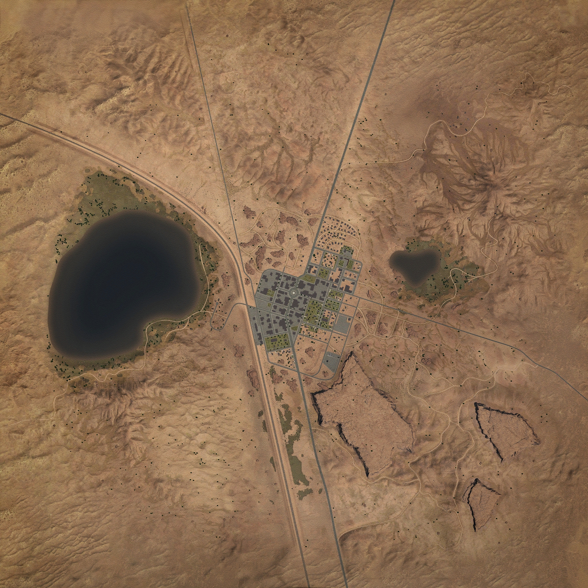
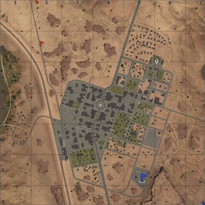
American Desert is a ground forces map available in all modes. It was added in Update 1.81 "The Valkyries". In Update 1.87 "Locked On" the map was updated so that nearly all buildings are destructible. The map is set in 1950s America, specifically the deserts of Arizona. The map consists of a small town (approximately 1km x 1km), and the surrounding desert. To the west of the town there is a large lake with a small neighbourhood on its southern bank and to the east of the town there is a smaller lake. To the south of the town there are some small mesas, while the area to the north of the town consists of more open desert. Currently all layouts of the map, available in normal matches, limit the battle area to just the town and a small amount of the surrounding area. A unique feature of the map is an animated train which makes its way from the south of the map along a railway line, running past the west of the town. Players can destroy the train and the train can collide with players, with both situations often leading to the train derailing.
The town itself is made up mostly of one and two story residential and commercial buildings, with a few three story buildings; it is made up of a few distinct areas. The south of the town is fairly open with some rocks helping to break up the area; it consists mostly of low density residential buildings, with a dilapidated fuel station in the south eastern corner of the town. The middle and northwest of the town is made up mostly of larger commercial buildings, with the west being taken up by a train station, one train is static and stopped at the platform, the moving train will pass through the station a few minutes into the battle. In the centre of the town there is a roundabout with a large statue in the middle of it. The eastern flank of the town, much like the south; consists mostly of low density, single story, residential buildings some of which have grass lawns while others have sand. There is also a large car park on the eastern edge of the town. The northeast of the town consists of a mix of residential and commercial buildings, more densely packed than in the south and east.
Across the railway track, west of the town, there is a large lake with a small neighbourhood built up along its southeast bank, the banks of the lake a significantly lower than the surrounding terrain. To the south of the lake there is a tall hill; terrain to the south of the hill consists of uneven open desert. To the north of the lake the railway banks round to the west, leaving the map in the northwest, north of the railway the terrain becomes extremely uneven with many tall sand dunes.
South / southeast of the town there are three tall mesas; the terrain between them is very uneven, being somewhat of a valley with numerous small hills and dips in the terrain; a number of dirt tracks cut through this area. To the east of the town there is a smaller lake with another small community built up on its eastern bank. Further east from the town the terrain turns into open desert, meanwhile to the north there is a tall hill with a radio tower and derelict hut at its peak. The area north of the lake is again largely open desert, but the terrain is much flatter than in other areas of the map, the terrain elevation is also notably lower than that of the main town. In the far northeast of the map there is a small rural settlement.
The full tank battles map is 4km x 4km, however this is usually restricted to just the main town, see the table below for the restricted size available in each game mode. The air battles map is 65km x 65km.
| Game Mode | AB | RB | SB |
|---|---|---|---|
| Domination | 1.35 km x 1.35 km | 1.35 km x 1.35 km | 1.35 km x 1.35 km |
| Conquest #1 | 1.35 km x 1.35 km | 1.35 km x 1.35 km | 1.35 km x 1.35 km |
| Conquest #2 | 1.35 km x 1.35 km | 1.35 km x 1.35 km | 1.35 km x 1.35 km |
| Conquest #3 | 1.35 km x 1.35 km | 1.35 km x 1.35 km | 1.35 km x 1.35 km |
| Battle | 1.35 km x 1.35 km | 1.35 km x 1.35 km | 1.35 km x 1.35 km |
Historical Background
The map is a fictional location set in the deserts in the southwest of the United States, the buildings and visual style of the map were inspired by the city of Page, Arizona, however the layout of the map bears little resemblance to the real location.
Map configuration
| Change Maps by Game Modes | ||
|---|---|---|
| | ||
At present this map has the same layouts in AB, RB and SB.
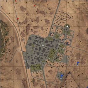
Domination
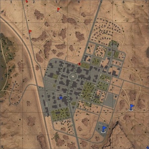
There are three capture points. Point A is at the train station in the west of the town, B is at the roundabout in the centre of the town, and C is at a church among the residential buildings in the northeast of the town.
| Domination Mode - Map Layouts |
|---|
|
1.35 km x 1.35 km 1.35 km x 1.35 km 1.35 km x 1.35 km |
|
In AB point A is at the train station in the west of the town, B is at the roundabout in the centre of the town, and C is at a church among the residential buildings in the northeast of the town. In RB point A is at the train station in the west of the town, B is at the roundabout in the centre of the town, and C is at a church among the residential buildings in the northeast of the town. In SB point A is at the train station in the west of the town, B is at the roundabout in the centre of the town, and C is at a church among the residential buildings in the northeast of the town. |
Conquest
| Conquest Mode - Map Layouts | ||
|---|---|---|
| Conquest #1 | Conquest #2 | Conquest #3 |
|
1.35 km x 1.35 km 1.35 km x 1.35 km 1.35 km x 1.35 km |
1.35 km x 1.35 km 1.35 km x 1.35 km 1.35 km x 1.35 km |
1.35 km x 1.35 km 1.35 km x 1.35 km 1.35 km x 1.35 km |
|
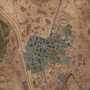
In AB the capture point is at the train station in the west of the town. In RB the capture point is at the train station in the west of the town. In SB the capture point is at the train station in the west of the town. |
In AB the capture point is at the roundabout in the centre of the town. In RB the capture point is at the roundabout in the centre of the town. In SB the capture point is at the roundabout in the centre of the town. |
In AB the capture point is at a church among the residential buildings in the northeast of the town. In RB the capture point is at a church among the residential buildings in the northeast of the town. In SB the capture point is at a church among the residential buildings in the northeast of the town. |
Battle
| Battle Mode - Map Layouts |
|---|
|
1.6 km x 1.6 km 1.6 km x 1.6 km 1.6 km x 1.6 km |
|
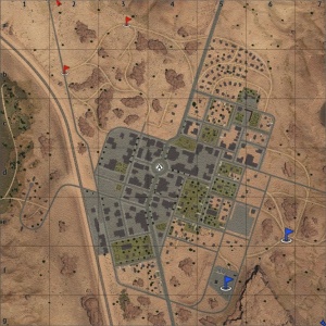
In AB the capture points are located behind some commercial buildings east of the train station, and at a small park in the north of the town (near the roundabout). In RB the capture points are located behind some commercial buildings east of the train station, and at a small park in the north of the town (near the roundabout). In SB the capture points are located behind some commercial buildings east of the train station, and at a small park in the north of the town (near the roundabout). |
Strategy
Describe what focus a team should have when spawning into the map
Media
- Videos
References


